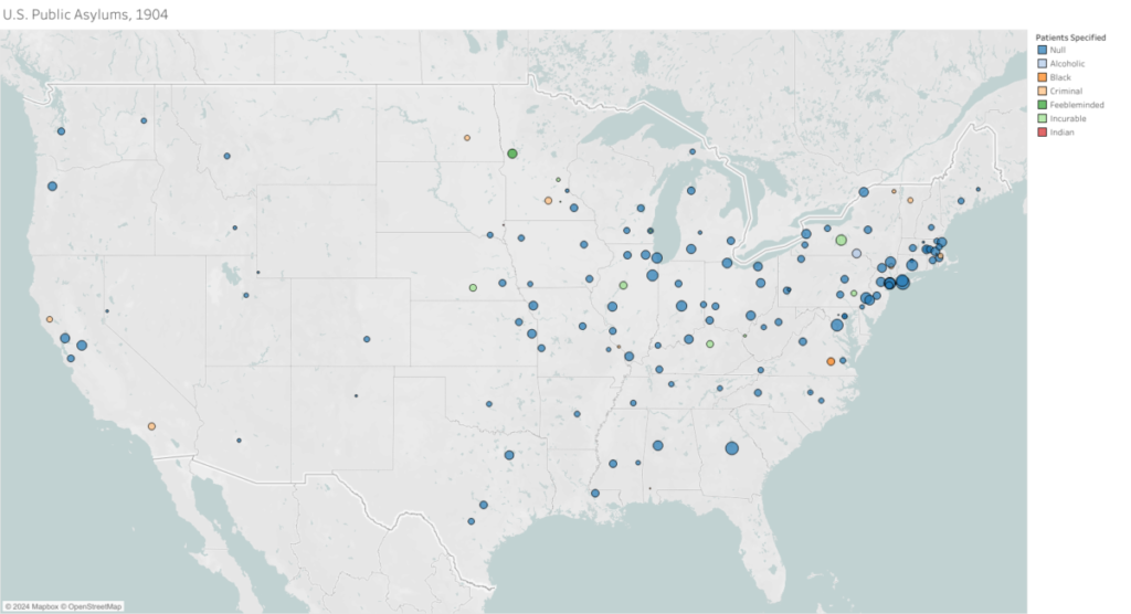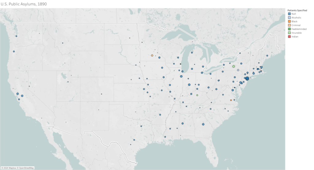
The map below is a prototype of the larger project. To access the interactive version, please follow the link to Tableau Public, where you will see two maps, one from 1890 and one from 1904. These visualizations of public institutions for psychiatric patients include population numbers, years opened and closed, bibliographic information, and other related information about each asylum. To see this information, simply hover your mouse over a circle: each circle corresponds to a particular asylum.
With the exceptions of years opened and closed, and the current use of each institution, all data for this project were sourced from the 1904 Department of Commerce and Labor Bureau of the Census Special Report on the Insane and Feebleminded in Hospitals and Institutions. This report is in the public domain and is available here.
As with any historical document, this report is partial. There were several extant public institutions during the period–like the Florida State Hospital in Chattahoochee–who neglected to report their patient numbers. These institutions are not reflected on the current map, though they will be included in the full map when it is complete. Additionally, it should be remembered that this information was utilized by the government to determine funding for publically funded hospitals and institutions, and that, as such, individual institutions may have had reason to over or under report their patient populations at a given time.
https://public.tableau.com/app/profile/lucy.wallitsch/viz/shared/6F6FR53XX