Wenhao Wang, Xiong Liu, Jianzhao Bi, Yang Liu, A machine learning model to estimate ground-level ozone concentrations in California using TROPOMI data and high-resolution meteorology, Environment International, Volume 158, 2022, 106917
https://doi.org/10.1016/j.envint.2021.106917
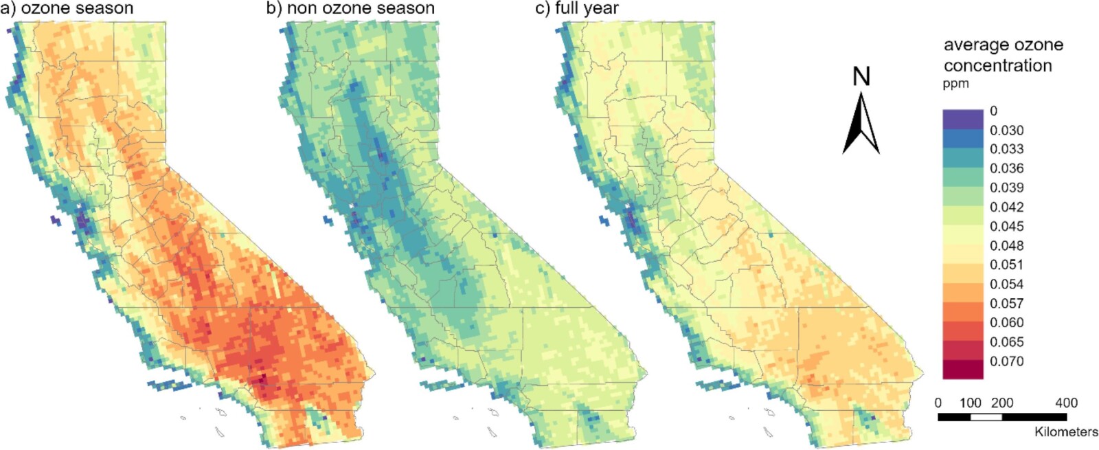
Abstract: Estimating ground-level ozone concentrations is crucial to study the adverse health effects of ozone exposure and better understand the impacts of ground-level ozone on biodiversity and vegetation. However, few studies have attempted to use satellite retrieved ozone as an indicator given their low sensitivity in the boundary layer. Using the Troposphere Monitoring Instrument (TROPOMI)’s total ozone column together with the ozone profile information retrieved by the Ozone Monitoring Instrument (OMI), as TROPOMI ozone profile product has not been released, we developed a machine learning model to estimate daily maximum 8-hour average ground-level ozone concentration at 10 km spatial resolution in California. In addition to satellite parameters, we included meteorological fields from the High-Resolution Rapid Refresh (HRRR) system at 3 km resolution and land-use information as predictors. Our model achieved an overall 10-fold cross-validation (CV) R2 of 0.84 with root mean square error (RMSE) of 0.0059 ppm, indicating a good agreement between model predictions and observations. Model predictions showed that the suburb of Los Angeles Metropolitan area had the highest ozone levels, while the Bay Area and the Pacific coast had the lowest. High ozone levels are also seen in Southern California and along the east side of the Central Valley. TROPOMI data improved the estimate of extreme values when compared to a similar model without it. Our study demonstrates the feasibility and value of using TROPOMI data in the spatiotemporal characterization of ground-level ozone concentration.
Keywords: Surface ozone; TROPOMI; OMI; Ozone profile; HRRR; Random forest; Spatiotemporal distribution
