Big week for the “OpenWorld Atlanta (OWA)” Team: ECDS members Michael Page, Jay Varner, and Alexander Cors presented the interdisciplinary project on Atlanta’s urban history at two international conferences last week. Together with international partners at the University of Arkansas, Yonsei University, and Stanford University, the OWA team talked about digital methods, open source software, and student research that drive the multi-platform project on Atlanta in the 1920s and 1930s.
OpenWorld Atlanta provides public access to historical information through engaging 3D and dynamic interfaces to the wealth of data extracted by the Emory Center for Digital Scholarship (ECDS) from historic maps, city directories, and archival collections from 1920s Atlanta. Between 1870 and 1940, Atlanta went through many changes and experienced rapid growth due to the influences of new economic investments and the development of heavy rail and the electric streetcar which by the 1940s made way for the commuter automobile which transformed Atlanta into the sprawling landscape it is today.
The project utilizes geodatabases of historical geographic features that are appended with information acquired from historical geocoders to create data rich and engaging interfaces for community and educational exploration. A team of interdisciplinary staff members, researchers, and graduate and undergraduate students work together to foster innovative methods and creative ideas to accomplish the dissemination of an existing body of work.
The Conferences
Geographer Michael Page and Lead Software Engineer Jay Varner traveled to Prizren, Kosovo, to attend the Open Source Geospatial Foundation’s FOSS4G (Free and Open Source Software for Geospatial) Conference.
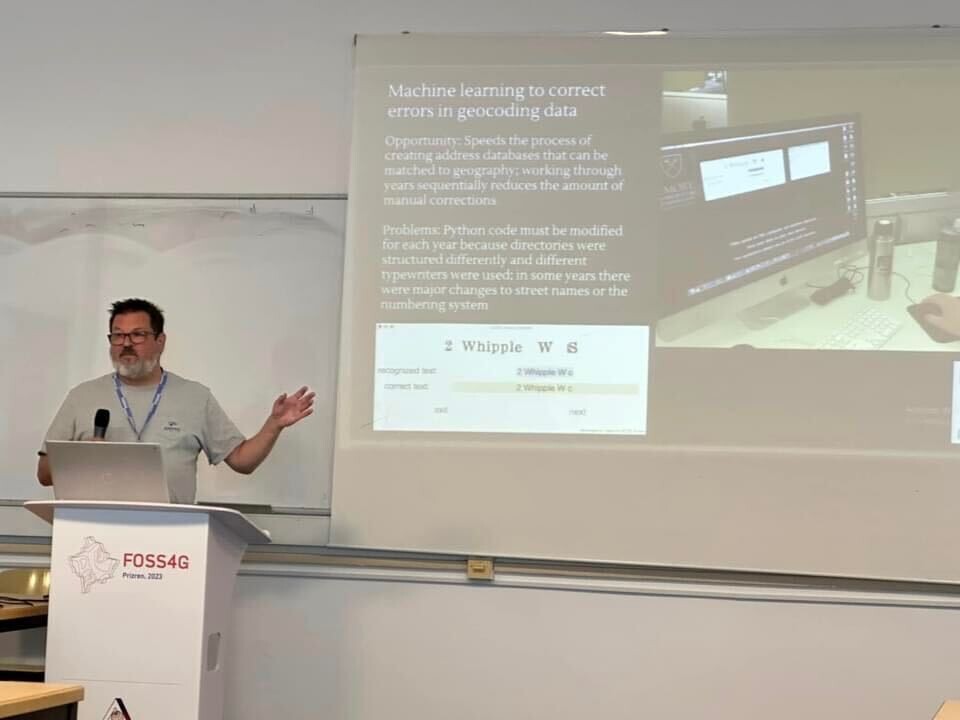 Michael Page speaking about how machine learning helped the team extract and clean up data about Atlanta residents from city directories
At the same time, Digital Historian Alexander Cors and Arya Basu, former ECDS Virtual Reality/Human-Computer Interaction researcher and now Assistant Professor at the University of Arkansas, presented the project at the Annual Conference of the Association for Arts and Humanities Computation.
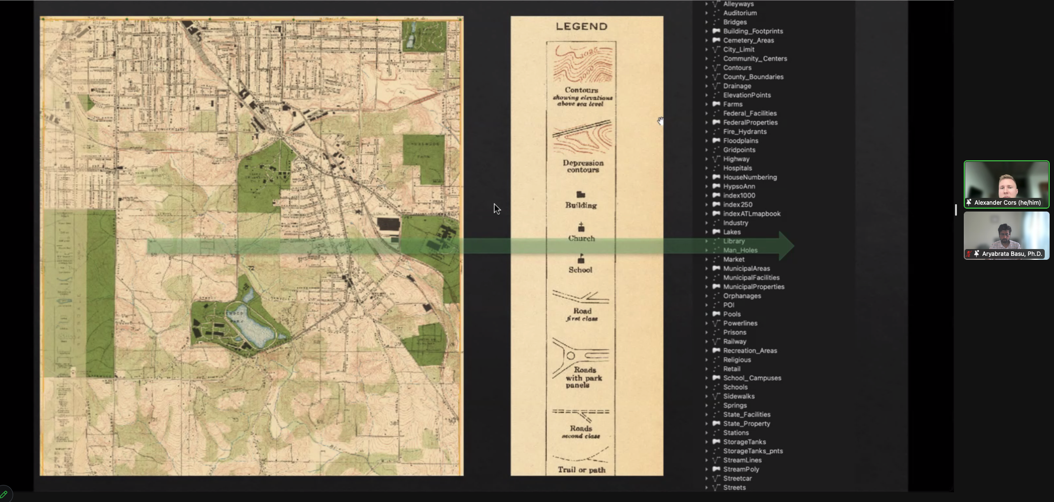 Alexander Cors explaining the various sources of data, including maps, insurance plans, and archival materials, that the team is bringing into the OWA interface
Presentation Summaries
Through a (re)mapping and spatial modeling of a city’s past, exploratory web applications can be built to examine urban histories and dynamically engage scholars and the public. Working on Emory University’s OpenWorld Atlanta project (OWA), researchers used geospatial technologies and methods to extract data from archives and other sources to build historical data models, geodatabases, and geocoders that enabled the development of web-based dynamic map interfaces. With a focus on the early stages of urban development of the city of Atlanta in the southeastern United States, this platform provides exploratory visualizations of city history along with a wealth of detail for specific time periods, specifically circa 1878 and 1928, given the opportunity provides by key map publications of the city. These dynamically enabled historical maps were then connected to digital images, geospatial vector data, descriptive text, and labels and then structured in a content management system.
While this project began as a digitization project centered on two atlases in the Rose Library collection at Emory University, it has grown to include contributors from several partner institutions. Now, the OWA project is situated within a larger consortium of institutions and researchers focusing on production methods, platform development, interface design, and evaluation using open-data and open-source methods and software in cities’ historical mapping and modeling. Drawing upon historical maps, city directories, archival collections, newspapers, and census data, projects like OWA allow researchers to analyze spatially grounded questions. In addition, they may serve the public as a valuable informational resource to learn about their neighborhood’s past and even contribute materials from family archives or stories.
For more information about the project:
Page, Michael, Younah Kang, Jay Varner, Keeheon Lee, Alexander Cors, Aryabrata Basu, Kim Durante, and Ian Burr. “Methods and Evaluation in the Historical Mapping of Cities.” The International Archives of the Photogrammetry, Remote Sensing and Spatial Information Sciences XLVIII-4-W7-2023 (June 22, 2023): 155–60. https://doi.org/10.5194/isprs-archives-XLVIII-4-W7-2023-155-2023.
Acknowledgement
The team would like to acknowledge the contributions of all the students who have worked on this project at varying degrees and over the years the project has been in development. The platform was only possible with their involvement. We thank the Halle Institute for Global Research at Emory University and the Yonsei University Frontier Lab for awarding a collaborative research grant to our team, enabling us to bring together scholars and practitioners from Atlanta and Seoul during multiple visits in the past four years