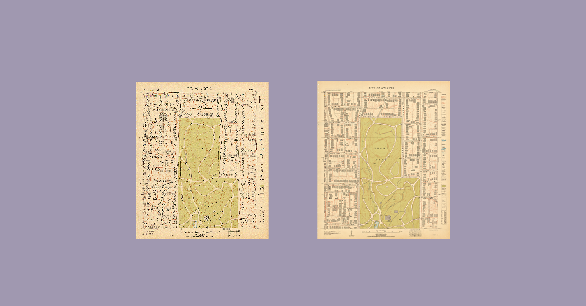
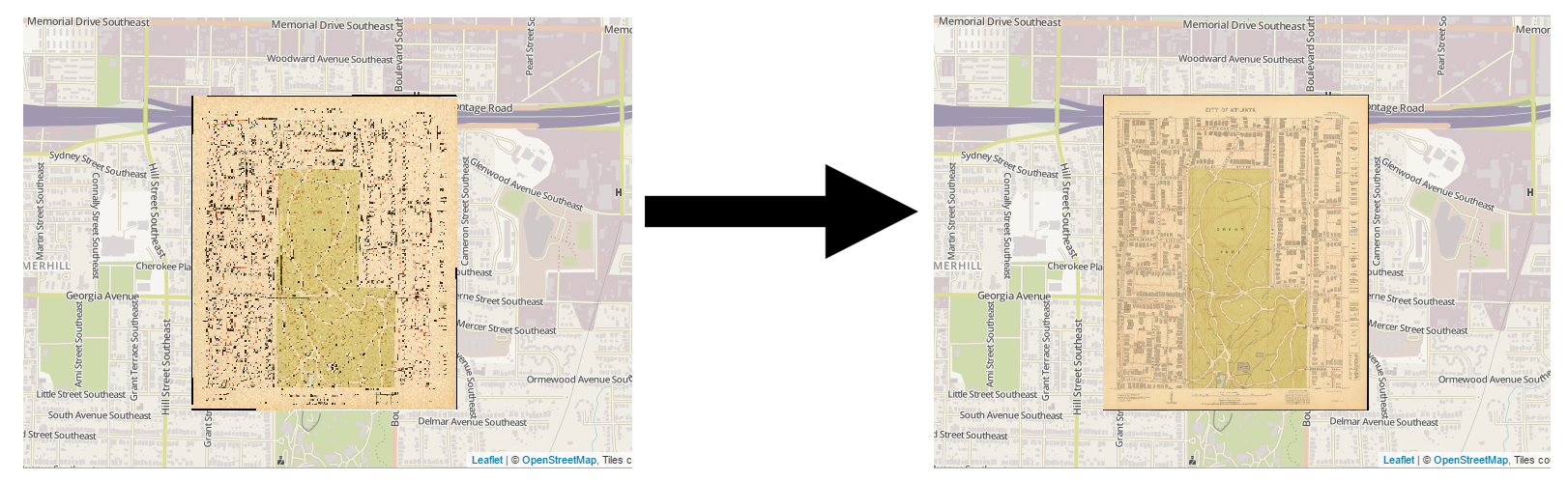
Today we’d like to share some exciting progress we’ve made on displaying georeferenced maps clearly online. In collaboration with the Library Software Engineering Team, we’ve been fine-tuning this process over the past several months. In short, we took some scanned historical Atlanta maps, georeferenced them, and overlaid them on a modern map using Geoserver and Leaflet. Unfortunately, they were terribly blurry unless zoomed to the maximum resolution. After a lot of research and trial-and-error, we now have maps that display clearly at all zoom levels.
Jay Varner (Library Software Engineer, Sr.) and I (Megan Slemons, GIS Librarian) have shared our findings at conferences this spring, and they are summarized in two blog posts on the Software Engineering team blog (and cross-posted here). Read about our journey below – we hope these steps will save others some trouble, and we are always looking for suggestions to further optimize this process!