The Georgia Coast Atlas—a partnership between Emory’s University’s Department of Environmental Sciences, Department of History, and the Emory Center for Digital Scholarship (ECDS)—was prominently featured in the news recently. The Emory University News article, “Georgia Coast Atlas: A Portal to Hidden Stories,” has been the top story on Emory University’s homepage since its publication three weeks ago. The article features insights from faculty, staff, and students who worked on the project, which is a “public, online gateway to the dynamic ecosystems and intriguing history of the state’s 100-mile-long coast and barrier islands.” The ongoing project includes flyover videos, annotated maps, and written and oral narratives, weaving together interdisciplinary scholarship in science and the humanities to create an unprecedented resource for educators, conservationists, students, and the general public.
- Article: https://news.emory.edu/features/2020/07/georgia-coast-atlas
- Link to Georgia Coast Atlas: http://georgiacoastatlas.org/
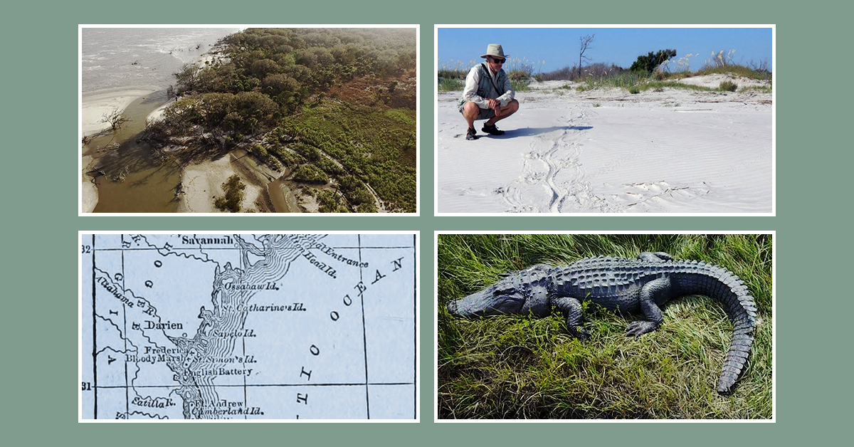
The article by Carol Clark features quotations and stories from several ECDS staff members and affiliated faculty. Dr. Anthony Martin (Environmental Sciences; pictured above) has been a frequent collaborator, who alongside Steve Bransford has produced and published flyover videos of the Georgia coast barrier islands for Southern Spaces (a peer-reviewed, multimedia, and open-access online journal supported by ECDS). You can read more about the Ossabaw Island flyover video in a previous ECDS blog post and the Sapelo Island flyover video in another blog post; read more about the St. Catherines Island flyover video on Southern Spaces.
Ossabaw Island Flyover video
(You can access video captions by clicking the “CC” button on the video player.)
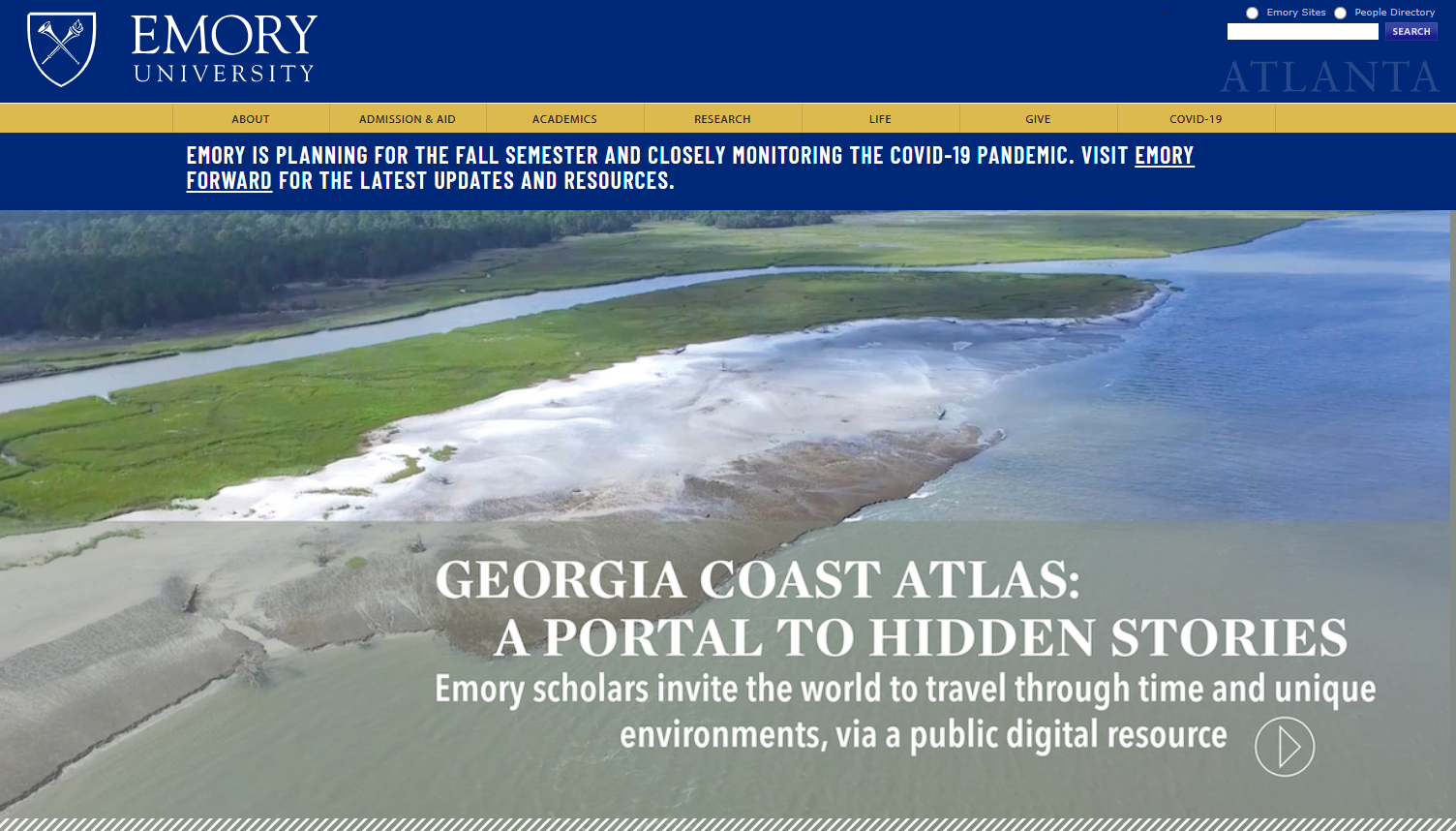
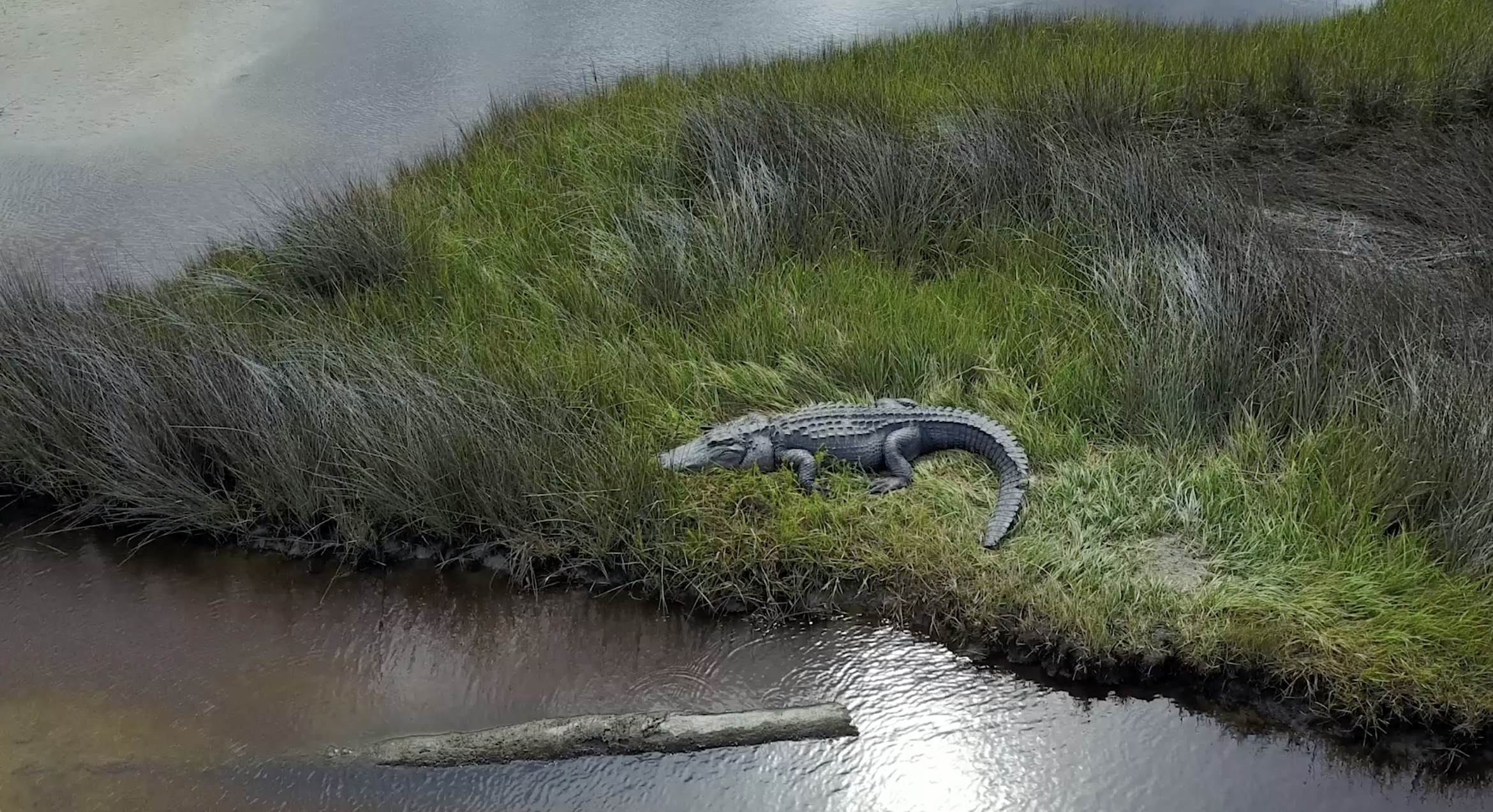
The Emory News article also features exciting insights from ECDS staff geographer Michael Page, who describes using an Unmanned Aerial System (UAS)—aka drone—to identify alligator dens. “It’s like having super vision,” Page told Clark. “You’re extending your eyes out far across the salt marsh and getting to see all these amazing landscapes and wildlife.” ECDS senior video producer Steve Bransford, who was also attracted by the prospect of capturing footage of alligator dens, describes the Georgia coast as a “national treasure” that is “ideal for digital scholarship.”
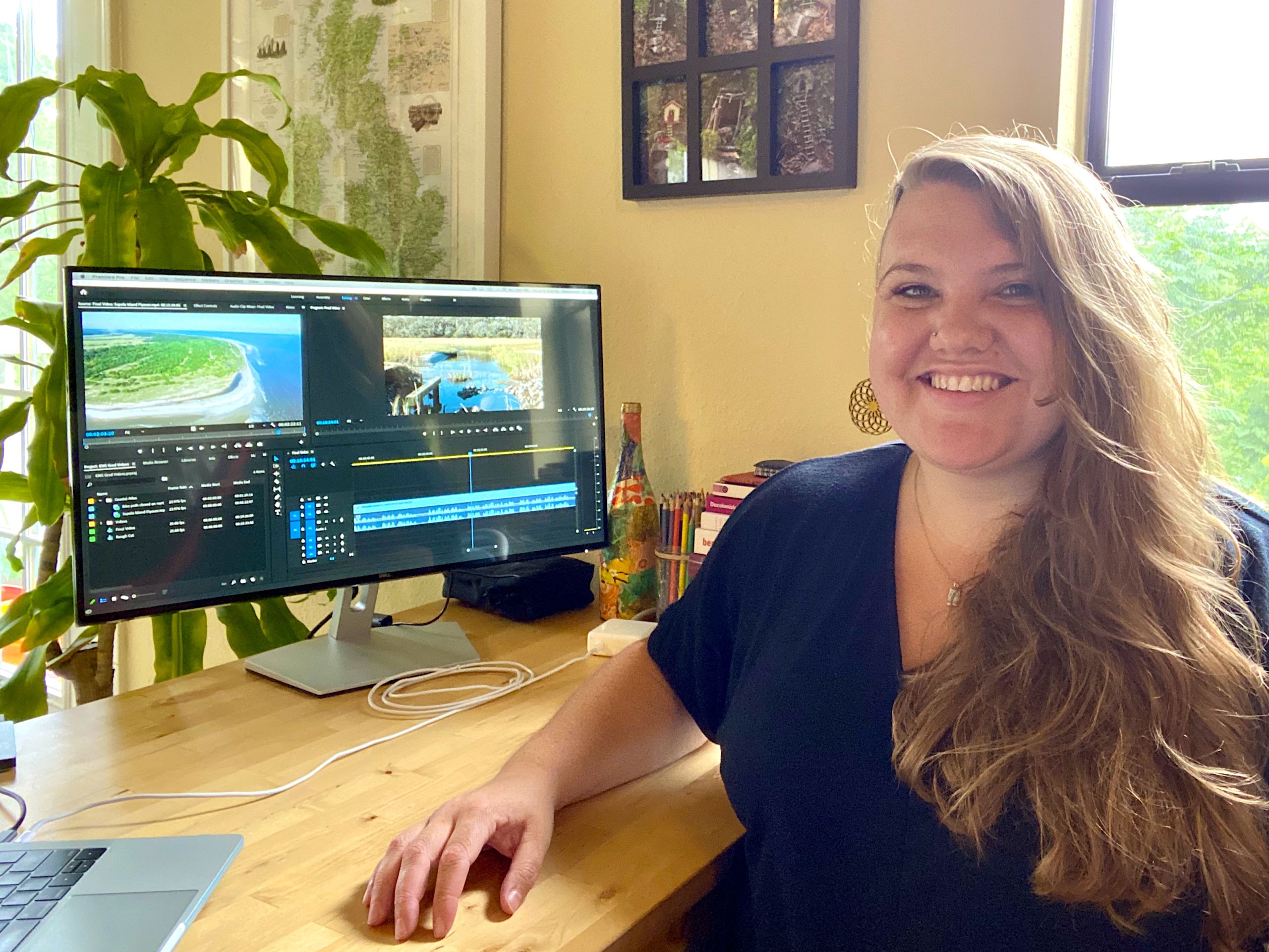
Graduate and undergraduate students worked alongside Page and Bransford, including ECDS graduate student Tesla Cariani (pictured below), who worked on video editing for the Georgia Coast Atlas. “I feel strongly that it’s a university’s job not just to teach students and do research, but to get knowledge out to the wider world,” she says in the article: “It’s a joy to work on the Atlas.” In the upcoming year, new students who will join the project include senior undergraduate student Katherine Walton, a Computer Science major, and Jared Gingrich, an Environmental Science graduate student.
Walton—who is currently working on the ECDS project OpenWorld Atlanta—will serve as the student programming lead for Georgia Coast Atlas in order to further develop the interface and mapping component. At the recommendation of Jay Varner (Lead Software Engineer at ECDS), the project team is considering the viability of using the platform Frontify for the Atlas. Frontify provides a relatively straightforward way to combine the CMS functionality of WordPress with the frontend framework foundation of React (a JavaScript library for building user interfaces). Walton will assess these technical needs when she joins the project team this Fall.
The Georgia Coast Atlas is an ongoing project. As Bransford states in the article, “The Atlas is still in its infancy […] but we have a great foundation for a comprehensive web portal for the Georgia coast. We plan to keep on building it out, and we hope to garner more contributions from scholars beyond Emory. We’re not setting a completion date, since the landscape is continuously changing.” Bransford adds: “We have access to a ton of historical maps and air photos of the barrier islands, and the plan is to add them as layers that can be turned on and off,” much like the layer options in another ECDS-partnered project and open resource, ATLMaps.
This ever-improving project will be a wonderful resource for many years to come. We encourage you to use Georgia Coast Atlas in the classroom and in your own research. (For any questions, you can contact: ecds [at] emory [dot] edu)