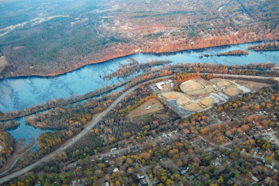
The Savannah River Basin encompasses 10,577 square miles, with the river itself being 301 miles long (Savannah River, n.d.). From its headwaters to its mouth at the Atlantic Ocean, the river flows through four different physiographic regions, including many different ecosystem types (The Savannah River, n.d.). The Savannah River Drainage Basin includes all water flowing into the Savannah, and includes land in Georgia, South Carolina, and North Carolina (Bonitatibus et al., 2015). A source-to-sink analysis of the drainage basin unveils changing channel networks and basin morphology as the river flows downstream. At its upper reaches, water is present in the form of manmade lakes (The Savannah River, n.d.). Water flows through the basin along the Savannah River, which is characterized as a meandering river as it gets closer to its lower reaches (The Savannah River, n.d.). By this point, few tributaries exist and the river flows to an estuary at its mouth, where tidal currents impact an already slow current (The Savannah River, n.d.).
Channel dynamics along the Savannah River are determined by natural geologic history but impacted by human influence. The river flows within an alluvial valley consisting of a top layer more coarse, angular, and poorly sorted than underlying sediments, at least within the Coastal Plain province (Leeth & Nagle, 1996). This riverbed likely formed during cycles of depositional infilling and entrenchment, leading to an uneven bedrock surface with a depositional layer up to 50 feet thick (Leeth & Nagle, 1996). During alluvial aggradation, the river migrated southwest due to tectonic activity while the alluvium eroded downwards through its bed, which is known as downcutting (Leeth & Nagle, 1996). This movement and erosion led to the formation of an erosional terrace around 45 feet below the current river (Leeth & Nagle, 1996). The streambed’s geologic history resulted in characteristic drainage basin landforms, such as gorges and knickpoints (N.C. Department of Environmental Quality, 2018). Gorges, like the Toxaway and Horsepasture river gorges, formed where the riverflow was able to erode sections of rock and alluvium, carving its path while surrounded by steep walls (N.C. Department of Environmental Quality, 2018). Knickpoints formed where the grade was disrupted, forming waterfalls (N.C. Department of Environmental Quality, 2018).
Recent human impacts to the stream have targeted its channel structure, straightening the stream for navigational reasons by removing river bends and imposing artificial meander cutoffs (Bonitatibus et al., 2015). This limits the ability of the Savannah to exhibit features like natural oxbows and sloughs. This disruption of natural flow has an impact on the river’s ability to transport sediment.
Heavy sediment loads carried by the Savannah river eventually make their way downstream into the port. Dredging operations are performed in order to remove sediments which gradually fill up channels, rivers, and ports (National Oceanic and Atmospheric Association, 2023). Although many bodies of water undergo dredging operations, these are especially essential in locations like the Savannah Port which handles nearly 10% of all US cargo (USACE, 2019). In 2006, it was announced that the Panama Canal would be widened, which would require Savannah Harbor to accommodate a higher quantity of ships by 2014 (Bynum, 2022, Brimmer & Chou, 2022). The US Army Corps of Engineers would draft plans to deepen the canal via dredging in order to meet this request.
Initially, the Savannah Harbor Expansion Project (SHEP) involved the transportation of channel sediment to the South Carolina side of the border. This sediment involved toxic cadmium, which would be damaging to South Carolina’s ecosystems and its imminent transportation was met with a lawsuit from environmental groups. Advocates for the SHEP wrote to Washington DC politicians in an attempt to prevent this suit, as it would cause a delay in the federally funded project (Associated Press, 2012). Congressionally authorized in 1999, the corps argued that an environmental review by South Carolina is not needed (Associated Press, 2012). However, the state judge from South Carolina ultimately sided with the environmentalists, noting the concern as both valid and premature (Associated Press, 2012).
The state legislature of South Carolina passed a resolution that suspended the Department of Health and Environmental Control’s (DHEC) authority to issue dredging permits. Despite a veto from Governor Nikki Haley, the legislature of South Carolina near-unanimously overrode her (Chourey, 2012). They argued that the DHEC overstepped its legal bounds by issuing a permit, disregarding other governmental bodies like the state’s Maritime Commission (Chourey, 2012). Additionally, legislators felt that this would be best for the state’s economy, as its Port of Charleston would preserve more relevancy without the SHEP, and the state’s environment (Chourey, 2012).
In 2022, the Savannah Harbor Expansion Project was completed (Brimmer. & Chou, 2022). The court settlement involved a required preservation of wetlands in addition to oxygenation machines which will supply native species like blue crabs and striped bass with ample oxygen (Bynum, 2019). These oxygenation machines would cost $100 million for the corps to install and $3 million per year to operate (Bynum, 2019). The hope is that they supply enough oxygen to offset what was lost in the dredging process, maintaining the compound which is valuable to wetland fauna nutrition. The channel was deepened 47 feet, which allows for larger ships to enter the port at a higher quantity (Bynum, 2019). Still, regular dredging operations will have to continue as sediment build-up occurs.
Peter Rubin and Murray Sternberg
Bibliography:
- Associated Press. (2012, November 29). “Attorneys try to settle Savannah dredge suit”. Savannah Now. https://www.savannahnow.com/story/news/2012/11/29/attorneys-try-settle-savannah-dredge-suit/13650377007/
- Associated Press. (2012, July 9). “Judge refuses to dismiss Savannah River lawsuit”. Atlanta Journal Constitution. https://www.ajc.com/news/local/judge-refuses-dismiss-savannah-river-lawsuit/CSvR4tghbwmDYCLarbC3SI/
- Brimmer, A.V. & Chou, Z. (2022, February 25). “Timeline: The Savannah Harbor Expansion Project was a deep – and lengthy – dig”. Savannah Now. https://www.savannahnow.com/story/opinion/2022/02/25/savannah-ga-harbor-expansion-project-dates-1996/6926936001/
- Bynum, R. (2022, March 9). “Savannah harbor deepening finished; dredging began in 2015”. AP News. https://apnews.com/article/business-environment-georgia-atlantic-ocean-panama-canal-c78bfe6ac0f24c276b79cf08f16cc8ba
- Bynum, R. (2019, August 15). “Agency: Oxygen injectors pass crucial test in Georgia harbor”. AP News. https://apnews.com/article/6c4ddba5418142e18f93dbea8e33e3e6
- Chourey, S. (2012, March 1). “Legislature overrides Haley veto, cancels deepening permit”. Savannah Now. https://www.savannahnow.com/story/news/2012/03/01/legislature-overrides-haley-veto-cancels/13662126007/
- Bonitatibus, T., Cantrell, M. A., Duncan, W. W., Hamstead, B., Krueger, E., & Wolf, M. (2015). A Scientific Basis for the Reconnection of Savannah River Artificial Meander Cutoffs through Flow Releases and Physical Reconfiguration.
- Leeth, D. C., & Nagle, D. D. (1996). Shallow subsurface geology of part of the Savannah River alluvial valley in the upper Coastal Plain of Georgia and South Carolina. Southeastern Geology, 36(1), 1–14.
- National Oceanic and Atmospheric Association. (2023, January 20). What is dredging? https://oceanservice.noaa.gov/facts/dredging.html
- N.C. Department of Environmental Quality. (2018). Savannah River Basin. https://files.nc.gov/deqee/documents/files/savannah-river_basin.pdf
- Savannah River. (n.d.). Georgia River Network. Retrieved October 19, 2023, from https://garivers.org/savannah-river/
- The Savannah River. (n.d.). Savannah Riverkeeper. Retrieved October 19, 2023, from https://www.savannahriverkeeper.org/the-savannah-river.html
- US Army Corps of Engineers, Savannah District. (2022, March 9). “Dredging complete for Savannah Harbor Expansion Project”. https://www.sas.usace.army.mil/Media/News-Releases/Article/2961490/dredging-complete-for-savannah-harbor-expansion-project/
Photo by Debs – originally posted to Flickr as DSC_0026.JPG, CC BY 2.0, https://commons.wikimedia.org/w/index.php?curid=4124686