S Wright Kennedy, a doctoral candidate in the History Department at Rice University, will deliver the fourth lecture in the of the MAP IT | Little Dots, Big Ideas series on Tuesday, 1 March, at 5.30 PM in the Jones Room, Woodruff Library. This presentation discusses the opportunities and limitations of the emerging historical geographic information systems (HGIS) approach to humanities research.  HGIS is a flexible tool that can provide new perspectives and insights on a wide range of humanities topics by unlocking a large body of untapped spatial sources, essentially opening new windows through which we can explore and analyze the past. Specifically, this presentation compares and contrasts four geo-humanities projects.
These projects include using HGIS to:
- study the workforce distributions and routes of the streetcar lines in late-nineteenth century Atlanta;
- map mortality and environmental conditions in the eighteenth-century transatlantic slave trade;
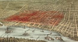
- identify the origins and track the spread of the 1878 yellow fever epidemic in Memphis, Tennessee;
- and, develop a GIS and open-access webmap that contains spatial layers and ephemera tracing the 450-year evolution of the city of Rio de Janeiro.
Through these projects, this presentation illustrates the variety of sources, scales, disciplinary focuses, critical versus conceptual constructions, and analytical techniques involved in HGIS research.
The MAP IT | Little Dots, Big Ideas includes seven workshops for people at Emory. For more information about the workshops and the workshop registration form, see: https://scholarblogs.emory.edu/dmh/workshops/.
Related LINKS
MAP IT | Little Dots, Big Idea series webpage
MAP IT Workshops (Emory community only)
Emory Report’s coverage of the series:And here is a link to the Emory Report’s coverage of the series: http://news.emory.edu/stories/2016/01/er_take_note_digital_mapping_series/campus.html
