With an elevation of 4,696 feet, Rabun Bald is the second-highest peak in Georgia, located immediately southeast of Sky Valley, Georgia. Its parent range is the Blue Ridge Mountains, a physiographic province of the larger Appalachian Mountains range. Approximately 320 million years ago, North American and Europe collided, pushing up the Blue Ridge and forming Rabun Bald.
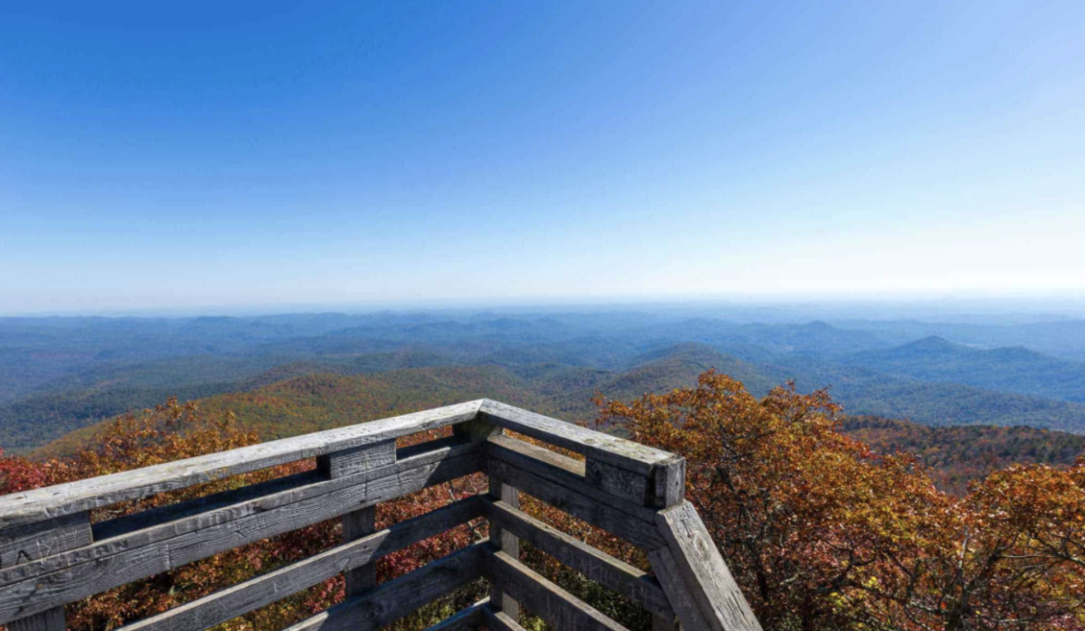
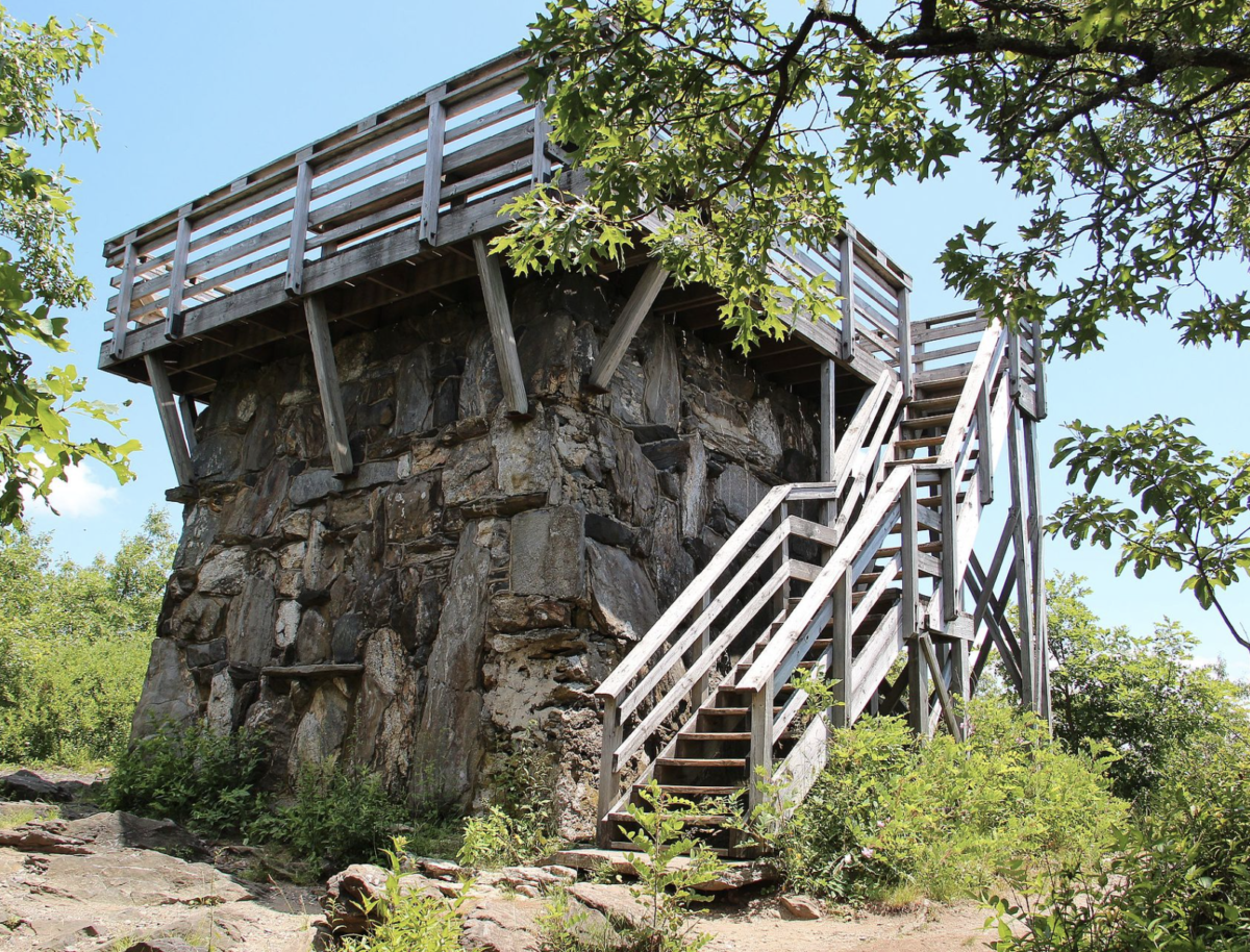
The United States Forest Service operated a fire tower on Rabun Bald until the early 1970s. After the fire tower was taken out of service, the stone base was left intact and a Youth Conservation Corps crew a railed wooden observation platform. Today, Rabun Bald is a tourist attraction for hikers especially. The observation tower on Rabun Bald’s summit provides hikers with views that, on clear days, extend for more than 100 miles. The hike to the top of Rabun Bald connects with the Bartram Trail system, which passes over the top as it winds through northeast Georgia for 37 miles.
References:
Wikimedia Foundation. (2020, October 16). Rabun Bald. Wikipedia. From https://en.wikipedia.org/wiki/Rabun_Bald.
Wikimedia Foundation. (2021, November 14). Blue Ridge Mountains. Wikipedia. From https://en.wikipedia.org/wiki/Blue_Ridge_Mountains.