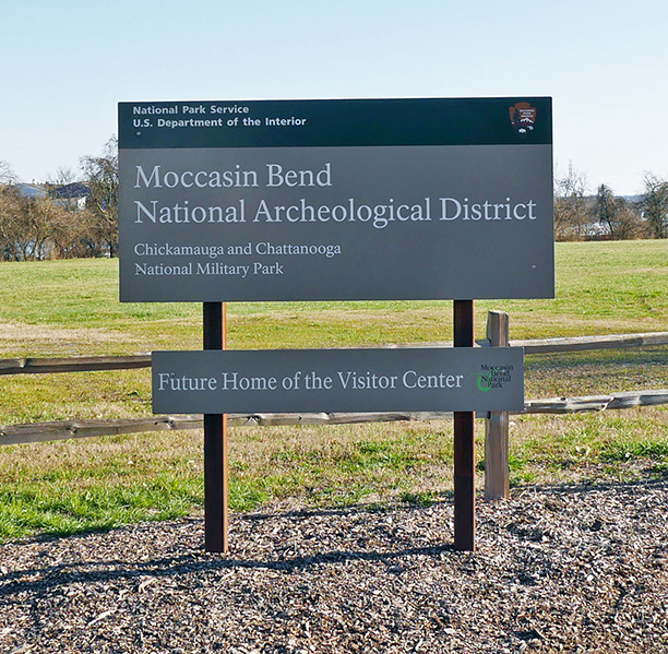
Our field experience on Moccasin Bend was about as extensive as it can get, however, that is not saying much. We drove down the entirety of Moccasin Bend Road, which runs right down the center of the bend; we hiked the Blue Blazes Trail that runs a loop around the center of the bend and we stopped by the National Archeological District for a quick photo. On the main road, there are only a few features of note. There is a golf course and sewage treatment plant towards the base of the bend, and a mental hospital right at the end. On the Blue Blazes Trial we were confronted with animal tracks, water logged paths, a swamp, extremely vegetated areas, large steel ‘No Dredging’ signs, a rapidly moving Tennessee River (swollen from a recent storm which also explains the waterlogged paths) and housing visible on the opposite bank. The Archeological District is located in a far more industrial area well on the way to Chattanooga and falls short of conjuring images of the Native Americans that once lived there.
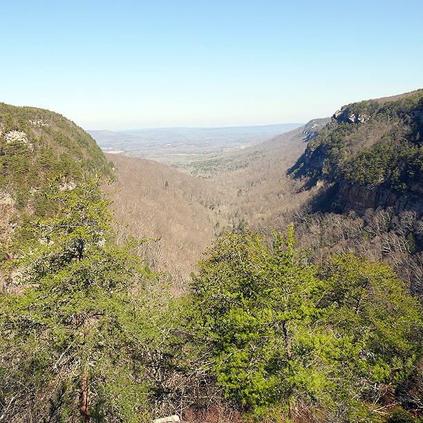
Moccasin Bend is nestled in the ridge and valley region of the lower Appalachian Mountains. Made up of layers of hard limestone and shale next to softer rocks, differing erosional characteristics created the ridges and valleys over 200 million years. As the softer rocks eroded, the alluvial sediment was deposited throughout the region, creating very fertile land. This is what first drew early Native Americans to the region.
Moccasin Bend has had human inhabitants for an incredible 12,000 years. With four long periods of Native American inhabitants, visited first by Spaniards and then Americans during the Civil War until today, the bend has experienced incredibly different cultures and its’ landscape has changed drastically because of it. Native Americans controlled the bend from 12,000 AD through 1838 when they were removed along the Trail of Tears. The visit from the Spaniards in 1540 or 1560 was amicable, unlike the interactions with Americans. In the 1900’s Americans began to build on the bend, first using it for farmland and later larger developments such as the mental hospital, golf course, sewage treatment plant and police firing range.
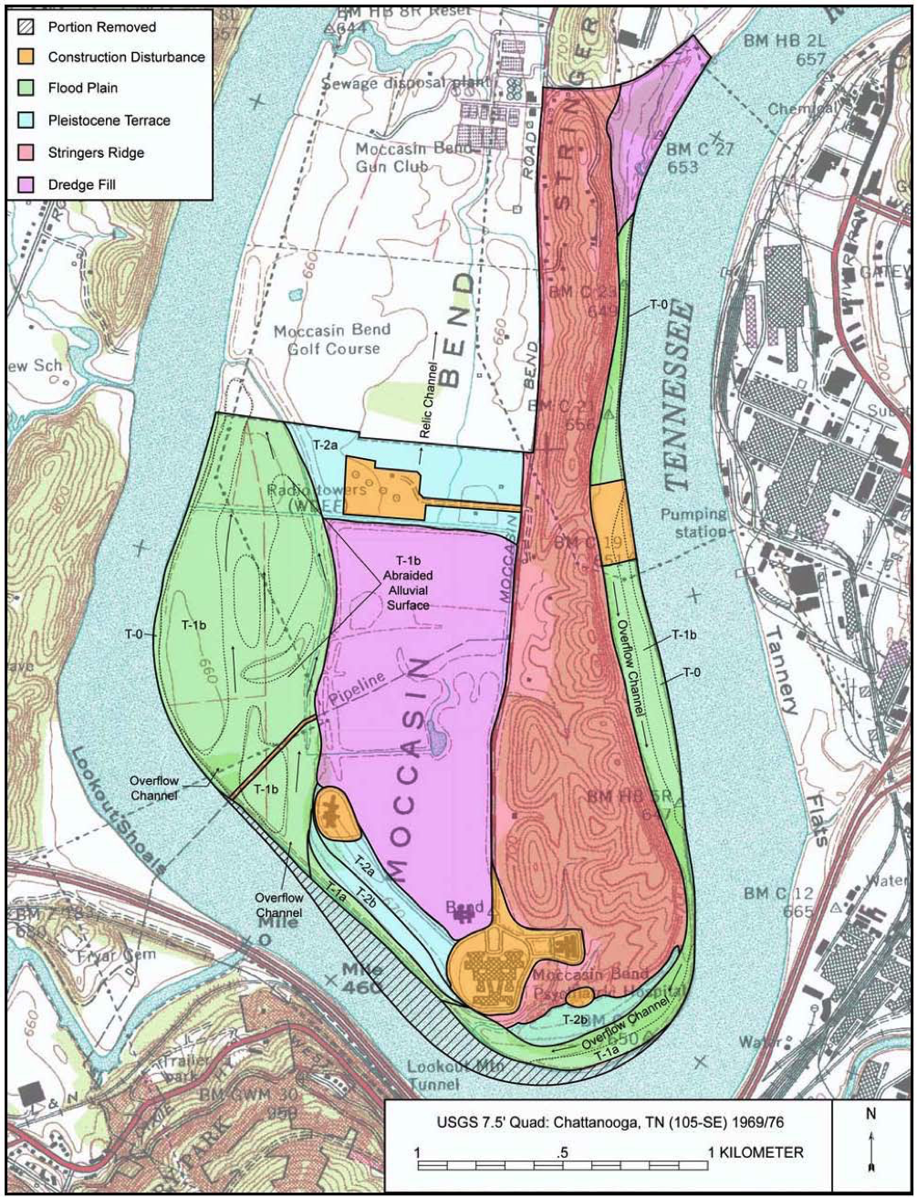
The main environmental issues facing Moccasin Bend today are the odor pollution from the sewage treatment plant and the presence of the current manmade structures on what is now a protected archeological park. In the 1960’s a barge company sliced off a large amount of land from the end of the bend to create a wider gap for their boats. The subsequent dumping of the material into the center of the bend has changed hydrologic features and therefore altered the landscape unnaturally.
At the moment the bend is in transition to being annexed into the Chickamauga and Chattanooga National Military Park and becoming the first protected archeological space in the national park system. It has long been signed into protection, since February 20th 2003, yet the park system is still trying to figure out what that should look like for Moccasin Bend.
Authored By: Simon Swart
Sources:
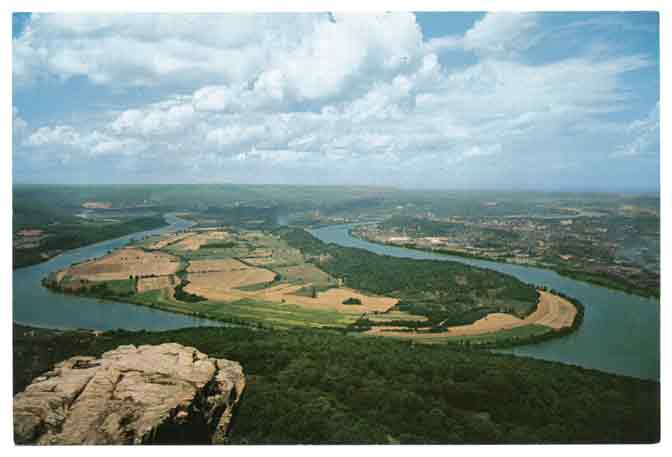
Cline, W. (n.d.). Giant postcard showing view of Moccasin Bend from Lookout Mountain [Photograph found in Digital Collection, Two Dimensional Nonprojected Graphic, Visual Materials, Electronic Resources, Chattanooga Public Library, Chattanooga]. Retrieved March 29, 2016, from http://catalog.lib.chattanooga.gov/polaris/search/title.aspx?ctx=1.1033.0.0.5&pos=21 (Originally photographed 1955)
National Park Service, United States Department of the Interior, & The Jaeger Company. (2014). Moccasin Bend Cultural Landscape Report (Rep.). Retrieved March 29, 2016.