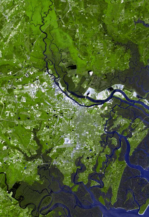
The Savannah river estuary, located in Savannah, Georgia, is the place where the Savannah river meets the Atlantic ocean. An estuary is formed when saltwater and freshwater mix. As a result of the mixing, estuaries have a salinity level intermediate freshwater and saltwater. The Savannah river estuary begins about 28 miles upstream from the Atlantic ocean, past the Interstate 95 bridge that connects Georgia and South Carolina.
The Savannah river splits into three rivers at this point as well: the Back river, the Middle river, and the Front river (or just the main Savannah river channel). The Back and Middle rivers are relatively narrow and shallow, and they sustain a 29,000 acre wildlife reserve that contains tidal freshwater marshes. The main Savannah river, however, is used for shipping and has been extensively widened and deepened to accommodate boats. Routine dredging ensures that the channel’s depth remains forty-two feet. Humans have extensively modified the landscape of the Savannah river estuary to suit their purposes, often at the expense of the native ecology. Dredging causes saltwater intrusion, and the increase in salinity that follows often decimates certain fish populations. Additionally, the estuary has been considerably polluted by industrial waste. The Savannah port is the United States’ tenth busiest port for container ships.
Below the city of Savannah the tides dominate the estuary. The water has higher salinity, and the river flows through extensive salt marshes. The difference between high and low tide can be up to seven feet, one of the highest tidal ranges in the Eastern United States.
Post written by Penelope Helm.
Sources/Further Reading:
Seabrook, C. (2006, October 13). Savannah River. New Georgia Encyclopedia. https://www.georgiaencyclopedia.org/articles/geography-environment/savannah-river/