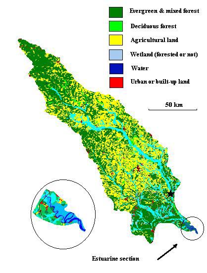
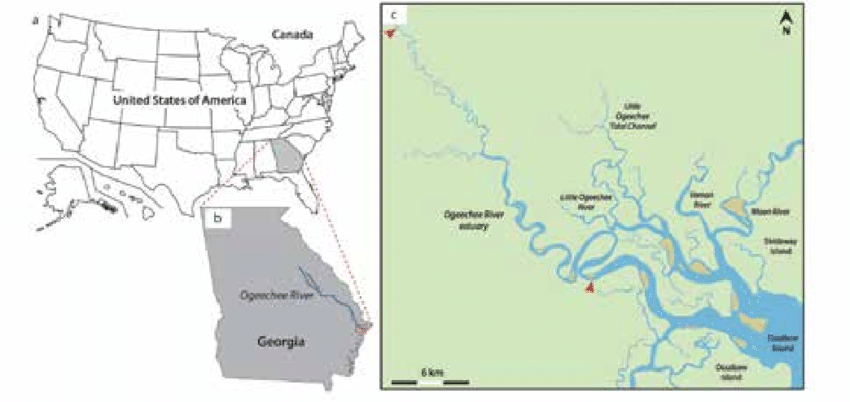
The Ogeechee river estuary is a large tidal estuary on the Georgia coast, just south of Savannah. It is primarily fed by the freshwater Ogeechee river, which marks the western edge of the Savannah river basin. The Ogeechee river is located entirely within the state, with its headwaters in the piedmont region of northeast Georgia. It is also one of Georgia’s few free-flowing rivers, meaning it has not been damned and the water can flow freely from the source to the sink.
The estuary is a fairly standard tidal system, consisting of a large central basin, complex barrier island systems, tidal creeks and extensive salt marshes. The strong freshwater outflow leads to extensive vertical mixing and a powerful current, helping to shape the surrounding barrier island, including Wassaw, Ossabaw, St. Catherines, Blackbeard and Sapelo Islands.
The Ogeechee river is considered a blackwater river. A blackwater river refers to a slow moving channel through forested swamps or wetlands. The decaying vegetation releases tannins into the water, giving the river the appearance of having black water. The water is perfectly safe to wildlife and can also be a sign of high biodiversity and plant life.
Sources and further reading:
Georgia River Network: https://garivers.org/ogeechee-river/
UMASS: http://fvcom.smast.umassd.edu/research_ogeechee_river/
Wikipedia: https://en.wikipedia.org/wiki/Ogeechee_River