Ogeechee River

Ogeechee River Watershed in highlighted area

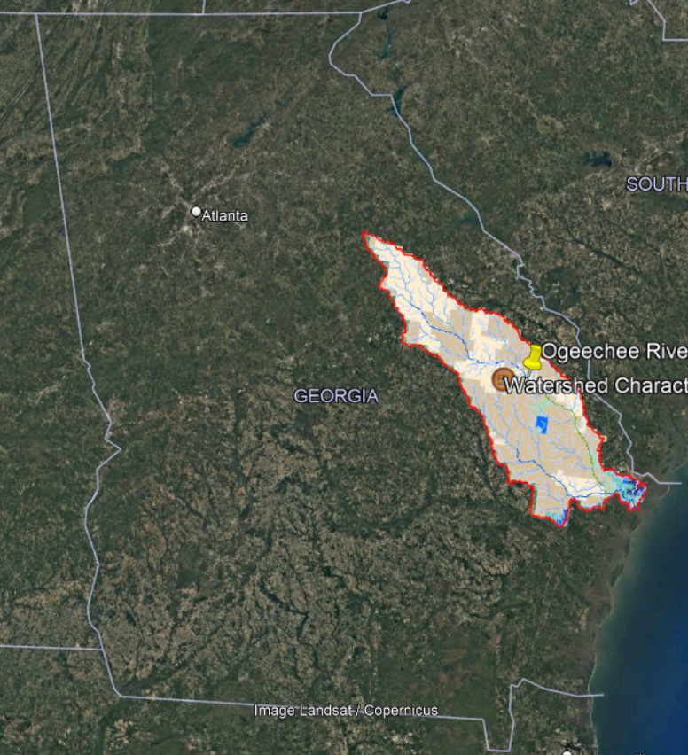
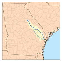
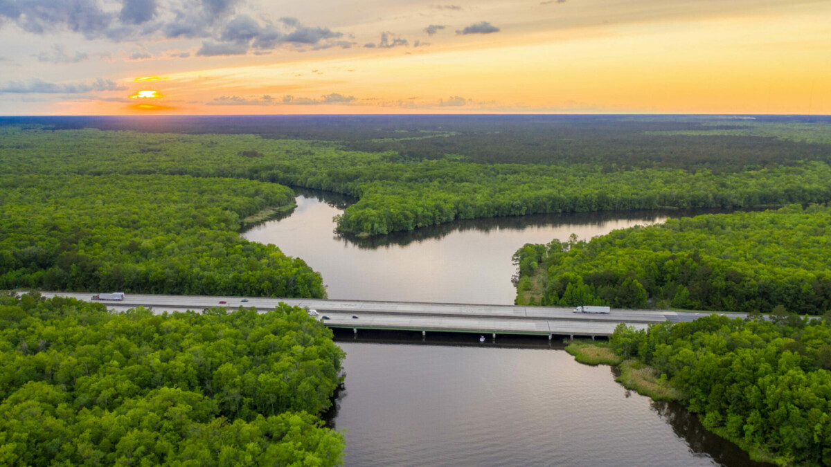
The Ogeechee Watershed is approximately 5000 square miles, with many tributaries and runoffs flowing into the main Ogeechee River. The river itself starts in the eastern part of the Piedmont region, flowing past Statesboro and ending in the Ossabaw Sound. Like the Flint River, it is also one of the only free flowing rivers above 200 miles in the United States. The area is interspersed with pine forests as is typical with the coastal plain region, as well as being marked by agricultural land which is also very common in this region. 

A clear outline of where the Ogeechee begins and ends.

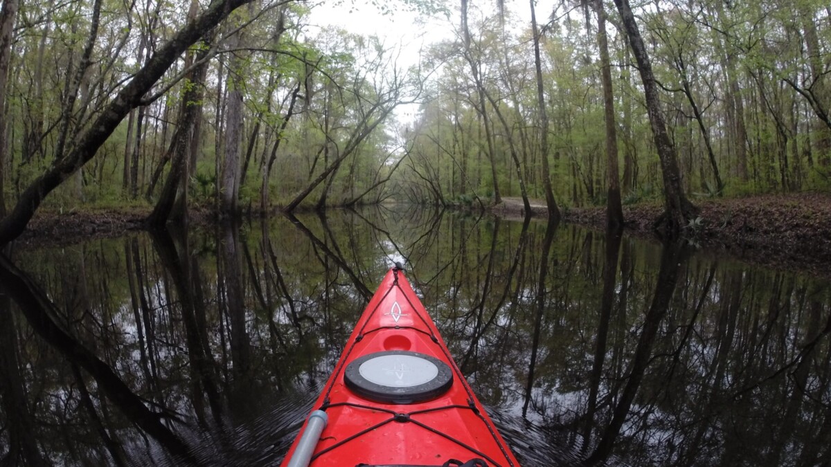
The main part of the river is in the coastal plain, but more on the eastern side in comparison with the location of the Kolomoki mounds. According to the EPA, rivers in the Coastal Plain region “meander broadly across flat plains created by river deposition and form complex wetland topographies, with natural levees, back swamps, and oxbow lakes. Typically, they drain densely vegetated watersheds; well-developed soils and moderate rains and subsurface flows keep suspended sediment levels in the rivers relatively low.” Because of the high sediment loads, it has been known as a blackwater river. The heavy sediment flow has its orginin all the way up in the Appalachian mountain, eventually making its way to lower areas of elevation and into the sea. 

Aerial photo of the Ogeechee river taken by the Ogeechee riverkeeper

The Mississippians and the Yuchi Native Americans lived in the Ogeechee river valley, and the name for the river is believed to have its origins in the Native American culture. Several towns and cities lie along the Ogeechee, as the watershed has been a major source of water for the region since people have inhabited it. Additionally, it has been used for trade and other commerce, a valuable asset because of the river’s connection to the ocean, allowing for transport of goods inland.

The Ogeechee River is known to be quite navigable for most kayakers and canoers minus the swampiness of the region.

Sources

Local History – Ogeechee Riverkeeper. (2016, May 1). Ogeechee Riverkeeper. https://www.ogeecheeriverkeeper.org/local-history/

Ogeechee River. (2020, December 17). Georgia River Network. https://garivers.org/ogeechee-river/

Sherpa Guides | Georgia | Coast | Savannah | Ogeechee River. (2021, January 1). Sherpa Guides. Retrieved December 3, 2021, from https://sherpaguides.com/georgia/coast/northern_coast/ogeechee_river.html

This post written by Jack Hudson, an undergraduate environmental science student at Emory University. 

Sand Mountain

Sand Mountain located in Northwest corner of Georgia and the region which surrounds it.

Sand Mountain is a large “sandstone” plateau that sits in the northwest corner of Georgia, crossing over into Alabama and Tennessee. Sand Mountain is a part of the Cumberland Plateau, the end section of the Appalachian plateau and mountain range. Sand Mountain is separated from the rest of the Cumberland Plateau by the Sequatchie Valley and the Tennessee River, and is approximately 1500 feet above sea level, about 800 feet higher than the rest of the region that surrounds it. The rocks in the cumberland plateau were formed in times where this region was covered by shallow sea level, approximately 360-320 million years ago during the Mississippian period. As sea level retreated, this area was exposed to weathering processes which continue to shape their appearance and landscape to this day. 

Cumberland Plateau which Sand Mountain is a part of

Sand Mountain has been inhabited for roughly 9000 years by what historians think were Cherokee and Creek Indians who initially followed herds of animals later establishing settlements in these areas.. Today, the area is filled with rural inhabitants, with some people being small scale farmers and other agrarian job holders. The area generally tends to be politically conservative, with many of the people being baptists. My family is actually from around Sand Mountain, and they were small scale farmers, being baptist and methodist, as well as conservative. The census data doesn’t lie I suppose!

View of Sand Mountain in Alabama and the landscape which surrounds it.

A lot of the land around this region is part of one of the largest contiguous forests in the Southeast, and prior to increased human influence, this region was covered entirely by this dense forest. Today, the region is inhabited by white tail deer, possums, and other common wildlife. The coyote has been able to take hold as the presence of larger apex predators like wolves and bears were largely eradicated from the Southeast due to overhunting and trapping by humans. 

View of the landscape of Sand Mountain

Sources

001, A. R. (2021, October 19). A Complete Guide To Sand Mountain Alabama. Usatales.Com. Retrieved December 3, 2021, from https://usatales.com/a-complete-guide-to-sand-mountain-alabama/

National Park Service. (2021, January). Geology and History of the Cumberland Plateau. https://www.nps.gov/biso/planyourvisit/upload/webgeo.pdf

This post written by Jack Hudson, an undergraduate environmental science student at Emory University. 

Kolomoki Mounds

Location of Kolomoki mounds in Georgia marked by the yellow pin. 

The Kolomoki Mounds located in SouthWest Georgia are found within the largest region of Georgia, the coastal plain region (specifically the upper coastal plain). Formed from the retreat of previously higher sea levels from warmer times in the planet’s history, the area around the Kolomoki mounds has been known to have limestone and sandstone deposits, as well as some phosphate deposits. Most of the trees that dominate the area around the Kolomoki mounds are pines, as is common in this region. Going into more specificity, weathering and erosion have led to the alteration in appearance of the mounds, as well as bioturbation. Wind, rain, and plants have acted upon these mounds over the last several hundred years, loosening the soils around and on top, flattening edges of these mounds, and almost disguising them into the landscape. Some trees have even established themselves on top of these mounds, adding to this changing appearance that is actively happening right now. 

The main mound from the site, overlooking what used to be a large plaza.

In terms of the cultural landscape, remnants of the civilization that created these mounds can be found throughout this area. Pottery, tools, weapons, and other items have been discovered; these items have indicated that these mounds were made by the Swift Creek Native Americans, the dominant group of people in this region. There are nine visible mounds in the area, with a major “plaza” area where researchers estimate around 1500-2000 Native Americans lived. There is one really large “Temple Mound” with other smaller burial and ceremonial mounds in the region; some of these mounds are thought to align with astronomical events like the spring equinox and the summer solstice. With this large amount of human activity, it is safe to assume that there was heavy human influence on the region through hunting, gathering, farming, and other land management practices. This site is part of a series of sites which are arranged in an almost perfect line running from the Gulf of Mexico to the Etowah mounds also found in Georgia. This perfect alignment challenges preconceived notions of the intelligence of the culture which built these mounds, suggesting they may have had more knowledge of the world than what was originally thought. 

The alignment of similar sites which start from the Gulf of Mexico and end in Western Georgia.

Sources

A. (2019, June 30). The Dirty Little Secrets of . . . Kolomoki Mounds. The Americas Revealed. https://apalacheresearch.com/2019/06/30/the-dirty-little-secrets-of-kolomoki-mounds/

Cox, D. (2014, November 20). Kolomoki Mounds State Park – Blakely, Georgia. Explore Southern History. Retrieved December 3, 2021, from https://www.exploresouthernhistory.com/kolomoki1.html

Kolomoki Mounds State Park | Department Of Natural Resources Division. (2021, January 1). GA State Parks. Retrieved December 3, 2021, from https://gastateparks.org/KolomokiMounds

This post written by Jack Hudson, an undergraduate environmental science student at Emory University. 

Lake Blackshear

Lake Blackshear

Lake Blackshear and the parts of the Flint River which lead into and away from the lake.

Lake Blackshear is a man-made lake that is approximately 8500 acres that sits on the Flint River, a river contained entirely in the state of Georgia. It originates south of Atlanta near the airport and runs through the Piedmont region, ending in Lake Seminole. Blackshear was formed from a dam made to harness “cheap” power for the region; the lake is home to a number of fish species like Largemouth Bass, Crappie, White Bass, Hybrid Bass, Striped Bass and Catfish according to the national park’s websites which are maintained by the park. The dam was made in 1930 and is the first dam after over 200 miles in the unimpeded Flint River, making it one of the longest unimpeded rivers in the US. Lake Blackshear has been characterized as “Eutrophic” or in excess of nutrients causing algae and other plant life to grow in excess. These processes make life for other organisms difficult, taking out a lot of nutrients from the water

The dam on the flint river which creates Lake Blackshear

Although Lake Blackshear is a manmade lake, it still has geomorphic processes which shape the land around its area. The placement of dams disrupts sediment flow, changing the behavior of the channel bed and surrounding land of the river downstream, inversely causing a buildup of this sediment above the dam. Above the lake, the Flint River flows through a swampy, forested channel with a sediment covered bed, but after the lake, the river flows through a limestone channel since there are fewer sediment deposits. In terms of cultural landscape, people have surrounded the lake, making use of its features for power, recreation, and real estate. There are many trees throughout the lake that are both dead and alive (those who engineered the dam thought these trees would die off due after the damming, but many still survive today). These make recreational boating quite difficult to the inexperienced boater. 

Boating on Lake Blackshear

Sources

Cordele. (2013, August 15). New Georgia Encyclopedia. https://www.georgiaencyclopedia.org/articles/counties-cities-neighborhoods/cordele/

Krakow, Kenneth K. (1975). Georgia Place-Names: Their History and Origins (PDF). Macon, GA: Winship Press. p. 20. ISBN 0-915430-00-2

Lake Blackshear. (2021, January 1). Crisp County Power Commission. Retrieved December 1, 2021, from https://crispcountypower.com/lake-blackshear

This post written by Jack Hudson, an undergraduate environmental science student at Emory University.