Oconee River

Oconee River Bridge Postcard. Image Sourced From Boston Public Library.

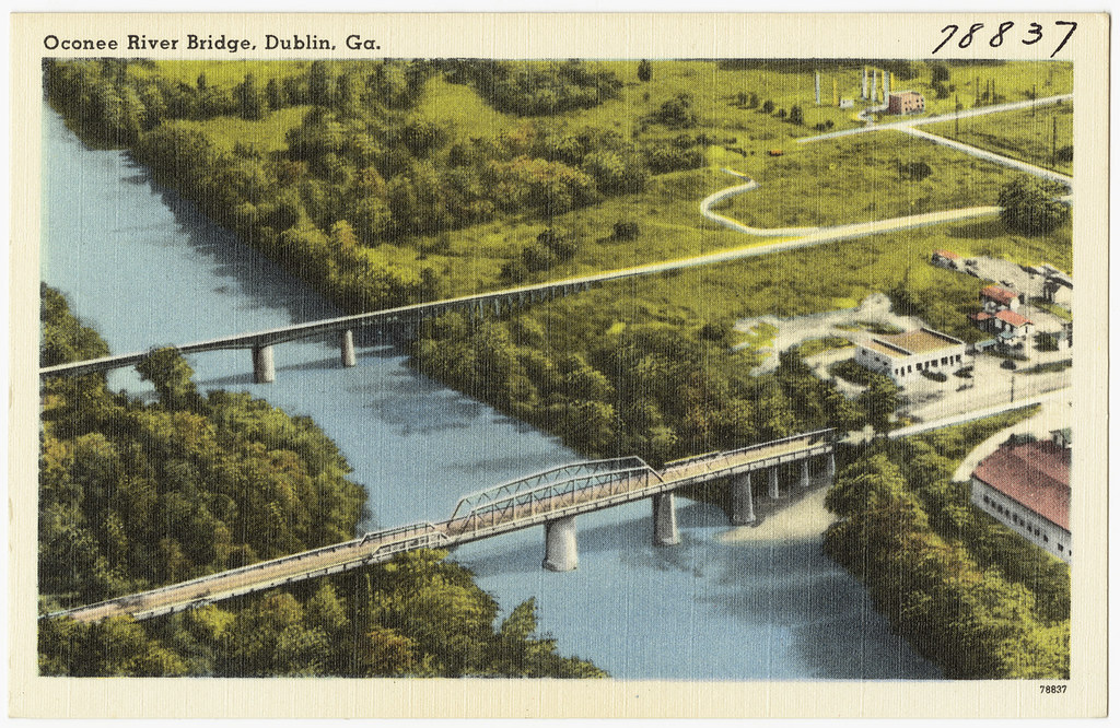
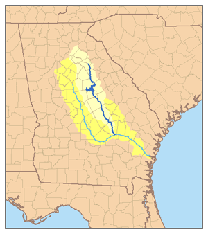
The Oconee river is a 220-mile-long river that originates in Hall County, Georgia, in Oconee National Forest, and ends where it joins the Ocmulgee River to form the Altamaha River. The Oconee flows through two man-made lakes: Lake Oconee and Lake Sinclair. The Oconee river basin drains 5,330 square miles. 

Altamaha river system. Oconee river is in dark blue. Sourced from Wikimedia.


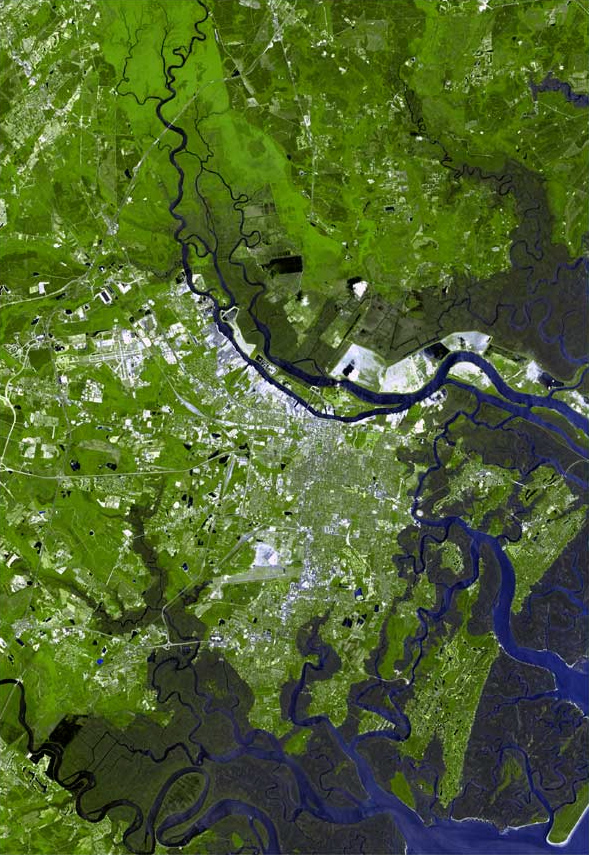
The Oconee river originates in the piedmont region of Georgia, where the rocks are largely metamorphic and resistant to erosion. Here, the Oconee’s channel largely consists of the two man-made lakes. In Milledgeville, Georgia’s former capital, the Oconee crosses the fall line, the boundary between Georgia’s piedmont and coastal plain physiographic regions. The coastal plain consists of younger sedimentary rocks that weather more easily. As a result, when the river enters the coastal plain, it becomes meandering and sinuous. This section of the river features many point bars, cut banks, meander loops, and oxbow lakes. Point bars occur on the inside of bends, where slower moving currents deposit small sediments. On the outside of these bends, faster currents erode the cut bank. As a result, meander loops expand over time until they are cut off, forming oxbow lakes.

Water from the Oconee is used for agricultural purposes and drinking water. The Oconee river basin provides water for more than 250,000 people in Georgia, and irrigates nearly 20,000 acres of farmland. The city of Athens is the largest municipal user of the Oconee’s drinking water. The Oconee is also used for a variety of recreational purposes, like fishing, birdwatching, and paddling. Another example is the Oconee River Greenway in Milledgeville, which includes walking and cycling trails, a dog park, boat ramps, and a farmer’s market. 

Post written by Penelope Helm.

Sources/Further Reading: 

Georgia River Network. (2018). Oconee River. https://garivers.org/oconee-river/

Oconee River Greenway. Geology of the Greenway and Geomorphic Processes of a Fluvial Environment [Brochure]. http://www.oconeerivergreenway.org/uploads/6/5/3/8/6538602/orgf_brochure.pdf

Oconee River Greenway. Oconee River Greenway.  http://www.oconeerivergreenway.org/

Warm Springs

The Warm Springs are located in Meriwether County, Georgia, about half a mile from the town of Warm Springs. The springs are located along the north base of Pine Mountain, and are in the Piedmont region of Georgia. Several other warm springs and some cold springs are also found in the area. 

The springs have always been of interest for the above-average temperature of the waters at about 88ºF. United States president Franklin D. Roosevelt first visited the springs in 1924 after a polio attack and continued visiting over the years. He even maintained a residence in Warm Springs, called the Little White House, which was his place of death in 1945. Before he died, Roosevelt created the Georgia Warm Springs Foundation to help treat other polio victims; the nonprofit ran an entire medical facility on-site. The pools Roosevelt swam in are now empty, and the Roosevelt Historic Pools & Warm Springs building is a museum and historic place. The drained pools are on display. The modern Roosevelt Warm Springs Rehabilitation Facility, a vocational rehabilitation center adjacent to the Little White House, still uses water from the springs for its rehabilitation pools.


FDR swimming in the warm springs, 1929.  

Image taken from U.S. National Archives.


One of the warm springs pools, 1928. 

Image taken from U.S. National Archives. 


The water for the warm springs falls as rain on the crest of Pine Mountain, and then infiltrates and becomes groundwater. The water is then carried to a depth of around 3,000 feet. The temperature underneath the Earth’s surface increases with depth, and as the water travels deeper, it heats, then eventually travels back to the Earth’s surface. Although it loses some heat as it ascends, the water remains warm, and is delivered to the springs at 88 degrees Fahrenheit. The rocks the water is carried through are a metamorphic, Precambrian formation called the Hollis Quartzite. Faulting allows water to percolate through the cracks. 

Post written by Penelope Helm. 

Sources/Further Reading:

National Park Service. (2020, August 11). Georgia: Warm Springs Historic District. https://www.nps.gov/places/georgia-warm-springs-historic-district.htm

United States Department of the Interior. (1937). The Warm Springs of Georgia: Their Geologic Relations and Origin. https://pubs.usgs.gov/wsp/0819/report.pdf

Savannah River Estuary

Savannah River Estuary Sourced from Wikimedia

The Savannah river estuary, located in Savannah, Georgia, is the place where the Savannah river meets the Atlantic ocean. An estuary is formed when saltwater and freshwater mix. As a result of the mixing, estuaries have a salinity level intermediate freshwater and saltwater. The Savannah river estuary begins about 28 miles upstream from the Atlantic ocean, past the Interstate 95 bridge that connects Georgia and South Carolina.

The Savannah river splits into three rivers at this point as well: the Back river, the Middle river, and the Front river (or just the main Savannah river channel). The Back and Middle rivers are relatively narrow and shallow, and they sustain a 29,000 acre wildlife reserve that contains tidal freshwater marshes. The main Savannah river, however, is used for shipping and has been extensively widened and deepened to accommodate boats. Routine dredging ensures that the channel’s depth remains forty-two feet. Humans have extensively modified the landscape of the Savannah river estuary to suit their purposes, often at the expense of the native ecology. Dredging causes saltwater intrusion, and the increase in salinity that follows often decimates certain fish populations. Additionally, the estuary has been considerably polluted by industrial waste. The Savannah port is the United States’ tenth busiest port for container ships. 

Below the city of Savannah the tides dominate the estuary. The water has higher salinity, and the river flows through extensive salt marshes. The difference between high and low tide can be up to seven feet, one of the highest tidal ranges in the Eastern United States.

Post written by Penelope Helm.

Sources/Further Reading: 

Seabrook, C. (2006, October 13). Savannah River. New Georgia Encyclopedia. https://www.georgiaencyclopedia.org/articles/geography-environment/savannah-river/

Sapelo Island

Sapelo Island’s Nannygoat beach. Image taken by Evangelio Gonzalez.

Sapelo Island is one of Georgia’s barrier islands. At 16,500 acres, Sapelo is the fourth largest. Like most of Georgia’s other barrier islands, Sapelo Island was formed by sediments from the Pleistocene epoch Silver Bluff shoreline, and the current Holocene shoreline. The island is a tidally-influenced barrier island, and experiences semidiurnal tidal cycles (two high and two low tides per day). Sapelo has many tidal creeks and marshes, which drain and refill with the tides. High tide pushes water into the marshes, and at low tide, when the ocean has receded, water drains from the marshes into the creeks. Changes in the tides can easily affect the island’s geomorphology. Hurricanes don’t often affect the Georgia coast, but storm surge from Hurricane Irma in 2017 created a new island between Blackbeard and Sapelo, called Little Blackbeard Island. 

Other Sapelo island ecological environments, aside from the tidal creeks and salt marshes, include beaches and sand dunes. Most of the beaches, including Cabretta and Nannygoat beach, are formed from Holocene sediments. These sediments originate from the continental shelf and are transported and deposited on Sapelo by the tides. The island’s upland areas are forested. The most common forest types are pine and maritime, which includes mixed oaks and hardwoods. 

Humans have lived on Sapelo Island for thousands of years. Archeologists have found evidence of Native American presence during Archaic times, including the Native American Shell Ring, a ceremonial mound. In the nineteenth century, Sapelo island was used for plantation agriculture. In the 1850s, 385 enslaved workers lived on the island. Ever since there has been an African-American community presence on the island, even following the civil war and the end of Sapelo’s plantation economy.  

In modern times, Sapelo island is managed by the state of Georgia, and is uninhabited with the exception of the Hog Hammock community. Visitors must be part of an organized tour or have a permit. Hog Hammock is a continuing landscape as the last known Gullah community. However, the Hog Hammock community is shrinking, and has less than a hundred residents. Some residents have willingly left the island, and others are at risk of being forced off. Since the 1990s, some mainlanders have been buying land from Gullah residents and building vacation homes, resulting in property tax increases that threaten the livelihood of some remaining Gullah residents. 

Post written by Penelope Helm.

Sources/Further Reading: 

Berson, S. (2018, January 29). Hurricane Irma created a whole new island off the Georgia Coast. Ledger-Inquirer. https://www.ledger-enquirer.com/news/state/georgia/article197172749.html

Georgia Coast Atlas. Sapelo Island. http://georgiacoastatlas.org/sapelo-island.html

Marine Institute on Sapelo Island. Island Habitats. University of Georgia. https://ugami.uga.edu/sapelo-island/island-habitats/

Sullivan, B. (2002, June 17). Sapelo Island. New Georgia Encyclopedia. https://www.georgiaencyclopedia.org/articles/geography-environment/sapelo-island/

Sapelo Island. (2021, November 25). In Wikipedia.  https://en.wikipedia.org/wiki/Sapelo_Island