Cloudland Canyon State Park attainted state park status in 1938 when the state began to buy the land from private owners. The state still purchases parcels of land to add on to the park today. Two of the former private owners still live in the area.
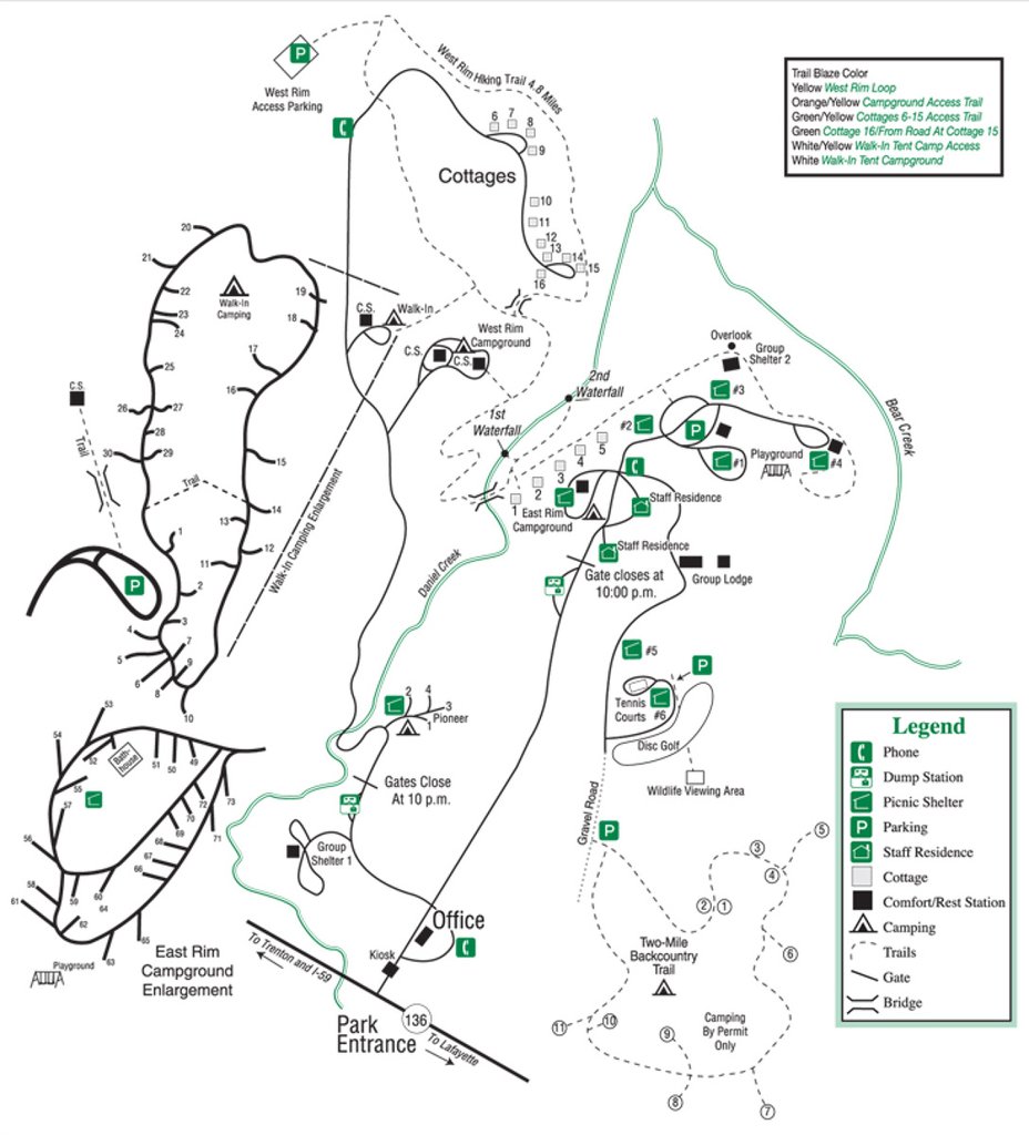
There are currently 16 cottages, 72 tent/trailer/rv campsites, 30 walk in campsites, 10 yurts, 5 picnic shelters, 1 group shelter, a pioneer campground, a group lodge that sleeps 40, a gift shop, a visitors center, an interpretive center, parking lots, phones, playgrounds, bridges, observation decks, a disc golf course and all the electricity lines and plumbing that going along with the facilities that consist of all the parks human impacts. The landscape developed over time because of the erosion of sandstone, which formed the canyons. Certain areas escaped human contact for difficulty of access and rare species of flora can still be found there. The park does not provide information on how many visitors they have per year.
Moccasin Bend has experienced change at human hands for 12,000 years. Since the start of that period, many groups of Native Americans used the Bend for hunting and gathering, burials, and agriculture. During the American civil war, union troops stationed artillery at the end of the Bend to lay covering fire on the side of Lookout Mountain, certainly altering the landscape.
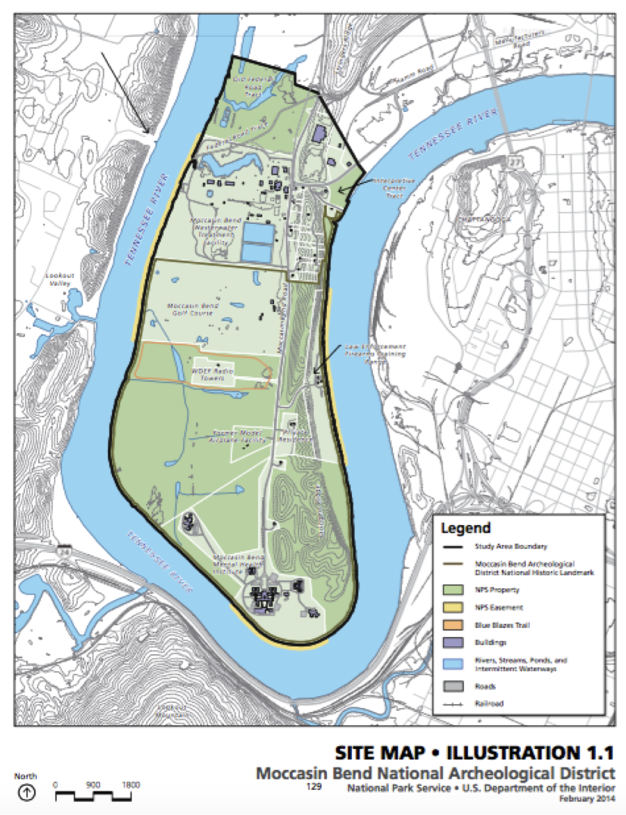
After that a constant discussion concerning the future conservation of the Bend took place until the 40’s when buildings still in place today began construction. These include a police shooting range, radio towers, a mental hospital, a waste management facility and a golf course. In the 60’s a barge company cut a chunk of land off the Bend for a larger shipping channel. There are roads and paths connecting all the buildings that cut through the forest and some large open green space near the buildings. A fair number of people use the paths for biking and running.
Chickamauga and Chattanooga National Military Park became the first military park in the United States in 1890 to preserve the battlefield where around 35,000 men lost their lives in a two-day battle during 1863.
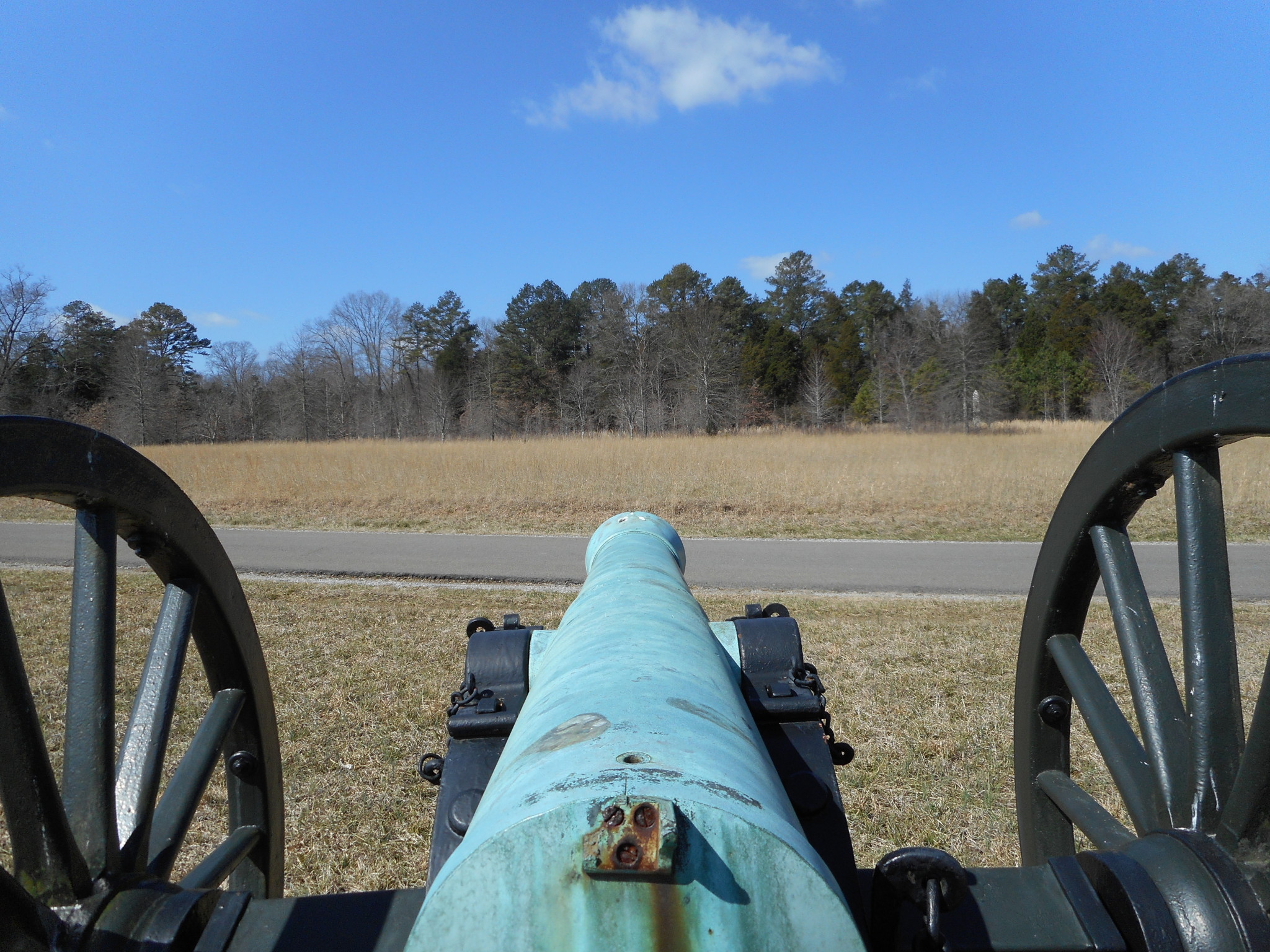
With two months of fighting in the surrounding area as well, the landscape was ravaged and the forest decimated. At the time, Chattanooga only had 2,500 residents as opposed to the over 170,000 that live there today. The park consists of 1,400 memorials and has close to 1 million visitors a year.
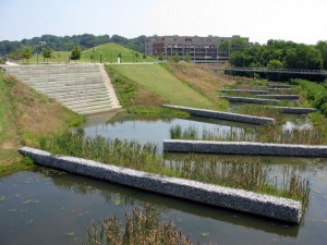
In 1984, Chattanooga Venture united resident and came up with plans to improve the city. Chattanooga went through a “renaissance” from the hands of landscape designers and planners. The Renaissance Park is an example. It has a 1.5 acre constructed wetland in downtown Chattanooga that replaced the former industrial plant. The contaminated soil from the 100 year old floodplain was removed. The wetland now has rock shelves and wetland plants, provides ecosystem services to wild life, and served as a unique outdoor recreational site for city dwellers. It improves water quality and collects water from stormwater runoff. When the water exits the wetlands, it flows into the Tennessee River, passing through a 13 acre flooded forest. The natural environment in urban Chattanooga is also subject to the interruption of natural water flows by Chickamauga Dam (operated by Tennessee Valley Authority), and pollution from its industrial past when residential neighborhoods were proximate to toxic waster sites and the air quality so bad that people drove with headlights on in the daytime. Human modifications in urban context happen fast and have long impact as demonstrated by Chattanooga.
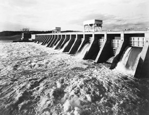
In the 1930s, FDR set up projects and agencies to save the America Great Depression. Tennessee Valley Authority is one such agency. The Tennessee Vally was flooded, deforested and eroded. TVA is designed by FDR to solve the problems of Tennessee Valley by “teaching better farming methods, replanting trees, and building dams”. In the process, TVA also helped to create jobs in the Tennessee Valley and provide electricity to people. However, the farming methods TVA taught included the promotion of inorganic fertilizer use which transformed the soil and disrupt the nitrogen cycle. TVA was also sued by a law student over the Endangered Species Act for the dam eliminate fish Snail darter and its habitat. TVA later petitioned to remove the snail darter.
Authored By: Simon Swart and Liu Yang
Works Cited:
Chickamauga & Chattanooga: Plan Your Visit & Death Knell of the Confederacy. National Park Service. 14. Feb. 2016. Web. 14. Feb. 2016.
Cloudland Canyon State Park. Georgia Department of Natural Resources State Parks & Historic Cites. 2016. Web. 14 Feb. 2016.
Glover, Ry. The Curious Case of Moccasin Bend. RootsRated: Where to go Outdoors. 14. Apr. 2015. Web. 14. Feb. 2016.
National Park Service, United States Department of the Interior, & The Jaeger Company. (2014). Moccasin Bend Cultural Landscape Report (Rep.). Retrieved March 29, 2016.
Madison, C. (1997, May). Chattanooga, Tennessee: The Sustainable Blue-Collar Town. Retrieved from http://www.utne.com/politics/americas-most-enlightened-towns-chattanooga-tennessee.aspx
Renaissance Park. (2014). Retrieved from http://landscapeperformance.org/case-study-briefs/renaissance-park
New Deal – Tennessee Valley Authority. (n.d.). Retrieved from http://juliamccartney.weebly.com/new-deal—tennessee-valley-authority.html
Whitehead, M. (n.d.). Environmental transformations: A geography of the anthropocene.
Murchison, K. M. (n.d.). THE SNAIL DARTER CASE. Retrieved from http://www.lawcourts.org/LPBR/reviews/murchison0807.htm