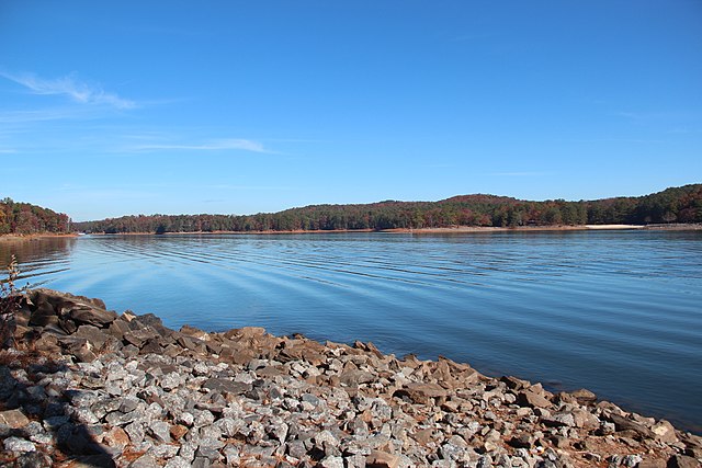
The Flood Control Acts gave the US Army Corps of Engineers the power to construct dams, reservoirs, and other flood prevention construction projects. One of these authorized by the 1941 act was Lake Allatoona. Located north of Atlanta, Lake Allatoona was created in the latter half of the 1940s when a dam was constructed at the Allatoona pass, and the reservoir that created the lake finished filling in 1950. A small town by the same name was flooded so that the reservoir could be filled. Overall, the lake covers over 12,000 acres and it has a maximum depth of 145 feet. The power station installed in the dam has a maximum capacity of 85 megawatts.
Its situation as a federally owned lake provides opportunities for the lake to be central to conservation efforts. There are two major conservation projects occurring at the lake. In the late 1990s, several manmade osprey nests were constructed at the lake to compensate for the fact that the only osprey nest in the state was on a dying tree. Furthermore, another project has begun to replace the longleaf pine forests that were once characteristic of the region, but then were cut down to make room for farms before the lake project was commissioned.
Thomson200, CC0, via Wikimedia Commons
Allatoona Lake. Mobile District, U.S. Army Corps of Engineers. (n.d.). Retrieved December 1, 2021, from https://www.sam.usace.army.mil/Missions/Civil-Works/Recreation/Allatoona-Lake/.
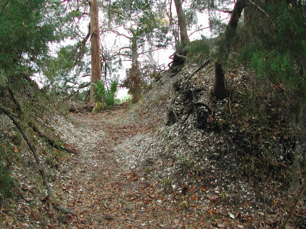
Located on Sapelo island, another of Georgia’s notable barrier islands, the shell ring complex are three consecutive mounds created by native people and may have been used for ritual or fortification purposes. These three mounds span over 250 feet in diameter and 20 feet in height. The rings have a trench that goes through it with the layering shells oulining the structure. These rings are the largest, but several other similar complexes have been found across the southeast in Georgia and Florida. A litany of artifacts are found within the rings, as well as shells and bones. This evidence has led to theories that the rings were used as trash heaps. At over 4000 years old, the rings on Sapelo island outdate many of the famous archaeological constructions on this planet.
Thompson, Victor. “Coastal Shell Rings.”, 2017
Daniels, G. C. (2018, March 4). Sapelo Shell Rings (2170 BC). LostWorlds.org. Retrieved December 1, 2021, from https://lostworlds.org/sapelo_shell_rings/.
Martin, A. (n.d.). Sapelo Island. The Georgia Coast Atlas | Sapelo Island. Retrieved December 1, 2021, from http://georgiacoastatlas.org/sapelo-island.html.
Thompson, V. (2017, June 6). Coastal Shell Rings – New Georgia encyclopedia. New Georgia Encyclopedia . Retrieved December 1, 2021, from https://www.georgiaencyclopedia.org/articles/history-archaeology/coastal-shell-rings.
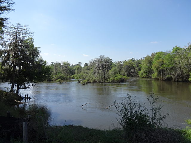
The Flint River is entirely contained in the state of Georgia flowing from Atlanta to the Gulf of Mexico. It is 334 miles long and has a drainage area of 8,460 sq. miles all which is prone to flooding. In relation, it is one of the only rivers in the country to flow 200 miles without a dam. The river originates as groundwater seeps from the ground. This groundwater is created by the stormwater runoff from the impervious surfaces of the area. As it moves down south the river is sustained by high precipitation of the region which contributes to the floodplains of the middle section of the river. The lower section of the river is slower and narrow as the water is farther from the source. This is a great example of source to sink where precipitation runoff seeps into the groundwater and flows down from granite terrain, to floodplains, to swamps, and eventually to the ocean in the Gulf of Mexico.
The wetlands created from the Flint River are around 412,000 acres of swamps, flood plains, creeks, and springs. This river is used for energy, agriculture, impoundments, and municipal/industrial uses for its surrounding areas. The river also consists of three dams. Low flow of the river is a cause for concern as drought increases and various water demands become higher.
Being a large source of water in the area, the Flint River is known as the most diverse river drainages east of the Mississippi, and home to many species of fish (Shoal Bass, Halloween Darter, trout, catfish), mussels, and vegetation. Some species have been a result of human impact as rainbow and brown trout, white catfish, and flathead catfish have been introduced. The fish within the river is used to feed the area which has been concerned with the increased amount of overfishing. Like most rivers the vegetation of the river is dense. Being in Georgia, trees like magnolias, cypresses, and sycamores can be found within the area of the river.
Looking into the future, the Flint River may be at risk. As the population grows, water and food demands become greater. Human impact and rising temperatures may result in the shrinking and slower flow of the river. This is detrimental to the fragile ecosystems and other geological features of the area making it a high priority area for sustainability and conservation.
Michael Rivera, CC BY-SA 4.0 , via Wikimedia Commons
American Rivers. (2019, May 15). Flint river Georgia . American Rivers. Retrieved December 1, 2021, from https://www.americanrivers.org/river/flint-river/.
Georgia River Network. (2021, February 16). Flint river. Georgia River Network. Retrieved December 1, 2021, from https://garivers.org/flint-river/.
Hicks, D., & Opsahl, S. (n.d.). Sherpa guides: Georgia: The natural Georgia series: The Flint River: The natural history of the Flint River. Sherpa Guides | Georgia | The Natural Georgia Series | The Flint River | The Natural History of the Flint River. Retrieved December 1, 2021, from https://www.sherpaguides.com/georgia/flint_river/natural_history/index.html.
Wikimedia Foundation. (2021, September 25). Flint river (Georgia). Wikipedia. Retrieved December 1, 2021, from https://en.wikipedia.org/wiki/Flint_River_(Georgia).
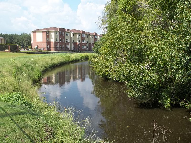
The Savannah Canal, also known as the Savannah-Ogeechee Barge Canal, is located in Savannah, GA. This canal was man-made in the 1820s by African and Irish laborers bringing crops and goods from the inland to theindustrial corridor, former rice fields, timber tracts of the 19th century south. Along its 16.5 miles, the canal’s waterway goes through four lift locks starting with its tidal lock in Savannah. After many years of use, the canal is now retired and has become a historical and environmental landmark in the state. It has many trials which show the interaction of human infrastructure and influence with the surrounding environment. The surrounding environment of the tidal swamp and river floodplain consists of large cypress trees, marsh life, pelicans, alligators, turtles, and much more. Nowadays, the canal is restored and protected by the Chatham County Parks, Recreation, and Cultural Affairs Department and the Savannah-Ogeechee Canal Society which is determined to share the historical and environmental importance of the area.
Ebyabe, CC BY-SA 3.0 , via Wikimedia Commons
Savannah Ogeechee Canal. (n.d.). About: Museum and nature center. Savannah Ogeechee Canal. Retrieved December 1, 2021, from https://www.savannahogeecheecanal.org/about.
Savannah-Ogeechee Canal Museum. (n.d.). Savannah-Ogeechee Canal Museum and nature center. Savannah-Ogeechee Canal Museum. Retrieved December 1, 2021, from http://www.socanalmuseum.com/.
Wikimedia Foundation. (2021, March 30). Savannah–Ogeechee Canal. Retrieved December 1, 2021, from https://en.wikipedia.org/wiki/Savannah%E2%80%93Ogeechee_Canal.