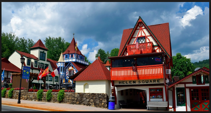
Helen is a small, Alpine-styled town in the heart of Georgia’s Blue Ridge Mountains. While similar to Dahlonega in that Helen’s downtown area is located relatively low topographically to its surroundings, Helen’s topography is much steeper, characteristic of its more northern mountainesque landscape. The core of the towns development is in the Chattahoochee River valley. On the topographic map below, the orange highlighted region follows the core of the towns anthropocentric development. This development corresponds to the relatively flatter terrain of the valley. Following this settlement pattern, Robertstown just northwest of Helen, is also located in a valley region were the Chattahoochee River meets Smith Creek. Logistically such valley regions are ideal for human settlement as the mountain slopes provide moderate protection from harsh winds, and the central river provides fresh water generating a linear pattern of development.
The downtown area of Helen is stylistically reductive to say the least. Faced with an economic crisis following the end of the local logging economy, the town decided to capitalize on its geography to draw in tourists. Catering to those with an affinity for the derivative, the town implemented strict zoning laws at the end of the 1960’s to regulate urban development and architectural style. While such laws have created the Bavarian-style village that exists today the town lacks an authentic, culturally historied identity, yet their largely tourism based economy has thrived.
Tourism in Helen
Once an economically depressed town, the townspeople in the late 1960s turned the once timber/lumber focused town into a Bavarian village, which is now the third most popular destination in Georgia, next to Atlanta and Savannah.Helen sits on the headwaters of the Chattahoochee River, along the edge of the Nacoochee Valley in White County. The area of Helen featured a myriad amount of virgin hardwood trees, a detail noticed by the Byrd-Matthews Corporation, a timber company which built a large sawmill in the town in 1910. The sawmill saw great success up until the Great Depression, at which point most of the timber had already been cut and processed. The town was essentially abandoned, and a ghost-town by the 1950s/60s.The Bavarian style came about in 1968, when a group of businessmen seeking the commerce of the those traveling to the mountains and waterfalls consulted a John Kollock. Kollock, a known regional artist stationed in Clarkesville, was inspired by his 1950s military service in southern Germany, and decided to model the new and improved Helen after his memories. Featuring buildings with chalet façades and red roofs, sales clerks who still wear lederhosen and dirndls, and several restaurants that still serve wiener schnitzel and sauerbraten, the business idea’s success is seen still today, as Helen sees over 1.5 million tourists yearly who spend upwards of $100 million annually in White County. In regards to tourism and activities, Helen is a town which has thrived and prospered. The town features genuine weinerschneitzel and German-cuisine themed restaurants, numerous specialty and gift shops, and one of Georgia’s oldest wineries. Its natural attractions are not lacking either, as the Anna Ruby Falls, Unicoi State Park, and Dukes Creek are all relatively nearby, as well as its own Chattahoochee River, which flows through the town itself, attracting numerous tubers and fishermen yearly. The town’s most popular events by far however are its three month long Oktoberfest (starting in September and ending in November) and the annual hot-air balloon race.
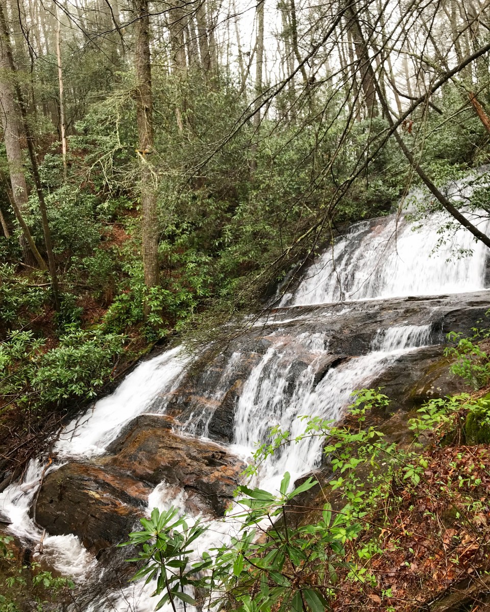
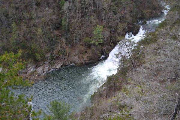
Duke’s Creek
Dukes Falls before the dropoff
Dukes Creek is a tributary creek and sub-watershed a part of the Upper Chattahoochee River Basin, and is located in White County, Georgia. A rather flat landscape which becomes gorgy, and draining an area of about 22 square miles, Dukes Creek is an area which contains a lot of exposed rock and Dukes Creek Falls, which is actually Davis Creek and falls directly into Dukes. The area near the falls is rather treacherous and arduous to navigate, so access becomes limited at a certain point (or at your own discretion). The Creek is 25-feet wide, has swift water, and is surrounded by white pine-hemlock.Dukes Creek’s botanical features include Carex ruthii (Ruth’s sedge) and Juncus gymnocarpus (naked fruit rush). There are the Dukes Creeks mines, which were established when gold was discovered in the valley along the creek.
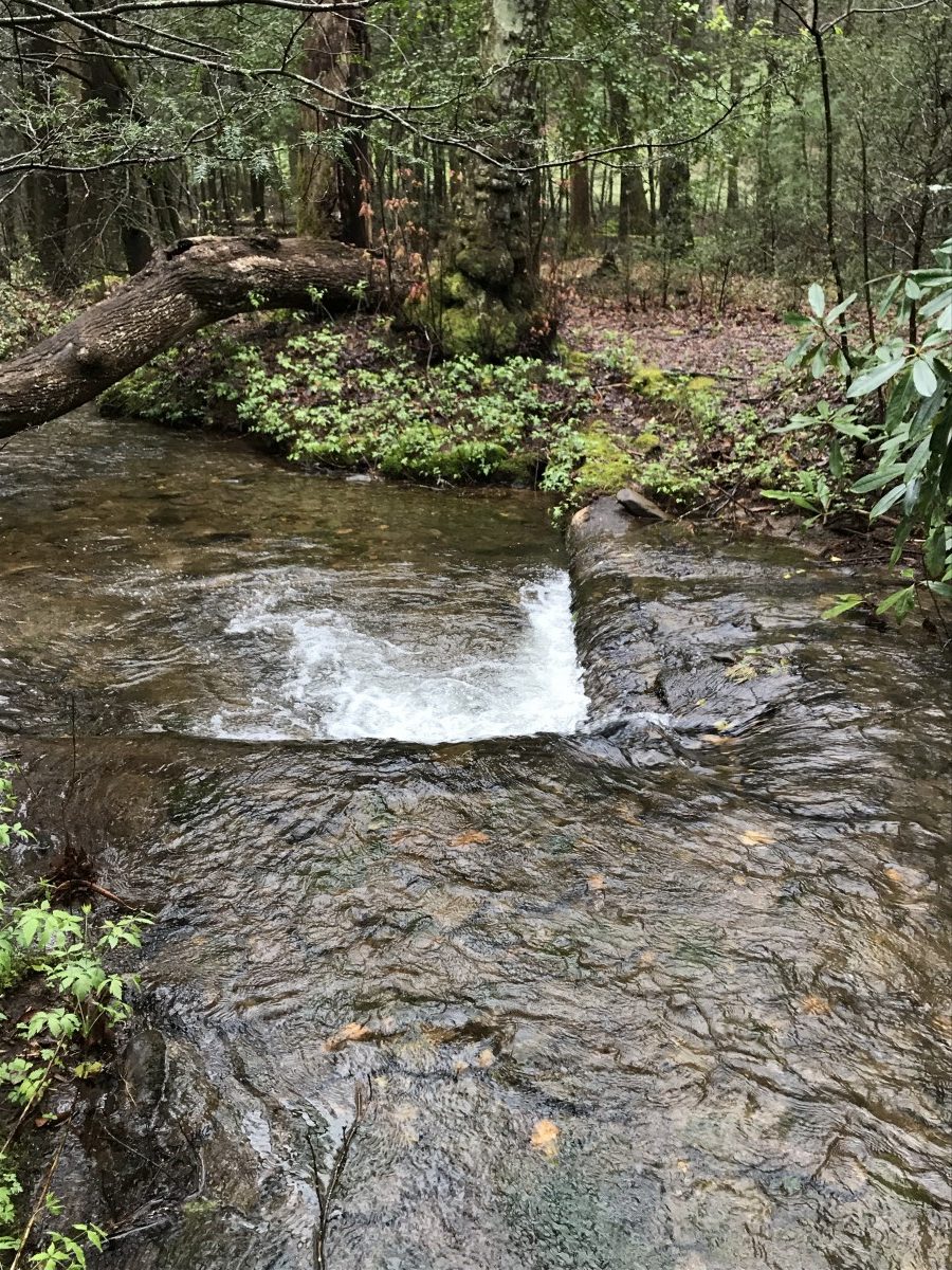
Upper Chattahoochee Watershed
Upper Chattahoochee River (v-shaped log jam damming up the river)
The Upper Chattahoochee is a sub-basin of the larger ACF River Basin (Apalachicola – Chattahoochee – Flint River Basin). It flows southwest to the confluence of the Chattahoochee River with Peachtree Creek. Covering 1,823 square miles, when combined with the Middle Chattahoochee River it is the largest river basin within the Metro Water District. All of the tributaries within this basin are free-flowing, and its flow is regulated primarily via Buford Dam. This basin is the primary drinking water supply source for the Metro Water District, distributing water to all/parts of eight District counties, including Cobb, DeKalb, Fulton and Gwinnett. The rock commonly found in the surrounding area of the Upper Chattahoochee is rock overlain with deposits of weathered, unconsolidated regolith, these deposits being thickest in valleys. Four soil associations describe the soil types in the Upper Chattahoochee River Subbasin best: Cecil-Madison-Pacolet, Madison-Davidson-Pacolet, Riverview-Chewacla-Cartecay and the “urban” soils that start in north Fulton County.
Cecil-Madison-Pacolet Soil: Associated with moderate rolling hills, well drained, highly weathered. Significance to Watershed Management: Sloping surfaces may be more susceptible to increased erosion due to stormwater runoff from impervious surfaces; well-drained soils may be more permeable, which increases infiltration capacity in areas without impervious cover, also may improve feasibility of infiltration practices.
Madison-Davidson-Pacolet Soil: Associated with steep terrain, well drained, highly weathered. Significance to Watershed Management: Steep terrain may be more susceptible to increased erosion due to stormwater runoff from impervious surfaces; well-drained soils may be more feasible for infiltration practices.
Riverview-Chewacla-Cartecay Soil: Found along the banks of some of the major rivers; less well drained. Significance to Watershed Management: Located near waterbodies, this soil type is characterized by flat terrain less susceptible to erosion due to stormwater runoff velocities from impervious surfaces; poor-drained soils are less feasible for infiltration.
Soils which were not present, yet should be mentioned are urban soils:
Urban Soils Characteristics: Highly disturbed and compacted soils. Significance to Watershed Management: Compacted soils; poor-drained, soils are less feasible for infiltration, restricted water drainage.
During our field research, we encountered a large number of campground sites littered throughout the surrounding areas. Unfortunately, said campgrounds were quite literally littered, unkempt, and dirty – there were numerous pieces of trash throughout all the campsites we saw, as well as bottles and pieces of broken glass on the ground. With more care and caution, these campgrounds could be made more valuable areas of natural interaction, though this will be dependent on our effort as human beings with a responsibility to the environment to make it so. Regardless, the sites we visited were full of rich ecology and intriguing geology which I wish we could’ve explored more intensively.
Contributors: Jinsol Kim, Graham Stopa
References.
Fred Brown and Nell Jones, eds., The Georgia Conservancy’s Guide to the North Georgia Mountains, 3d ed. (Atlanta: Longstreet Press, 1996).
John C. Inscoe, “Appalachian Otherness, Real and Perceived,” in The New Georgia Guide (Athens: University of Georgia Press, 1996).
Upper Chattahoochee River Basin Profile.” WATER RESOURCE MANAGEMENT PLAN PAGE UC-1 METROPOLITAN NORTH GEORGIA WATER PLANNING DISTRICT, northgeorgiawater.org/wp-content/uploads/2016/12/Appendix-A-Upper-Chattahoochee-River-Basin-Profiles.pdf.
Northgeorgiawater.org. (2016, October). Retrieved April 20, 2018, from northgeorgiawater.org/wp-content/uploads/2016/12/Appendix-A-Upper-Chattahoochee-River-Basin-Profiles.pdf.
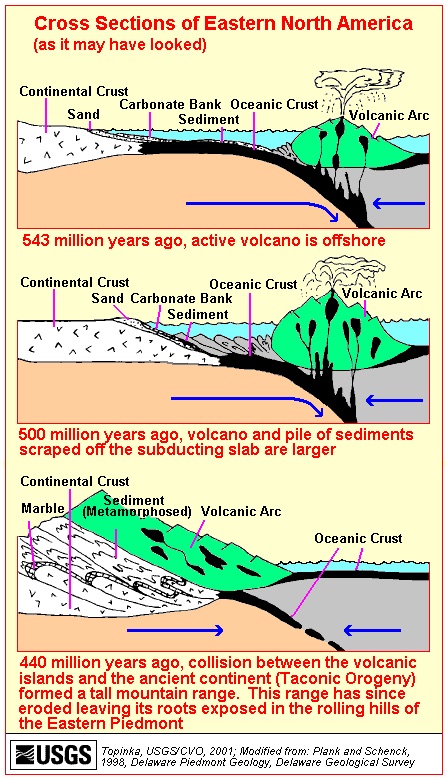
The Dahlonega Gold Belt is an extensive gold deposit that covers Georgia from Alabama to North Carolina. These mines are part of an extensive gold deposit that covers Georgia from Alabama to North Carolina and has been mined or prospected at least 217 sites.
While Dahlonega is currently nestled in the low-relief foothills of the rolling Blue Ridge mountains, the Dahlonega gold deposits at the Crisson Gold Mines and Consolidated Gold Mines remind us of a time in earth history when the Eastern side of North America was constantly subject to the colossal forces of tectonic collision.
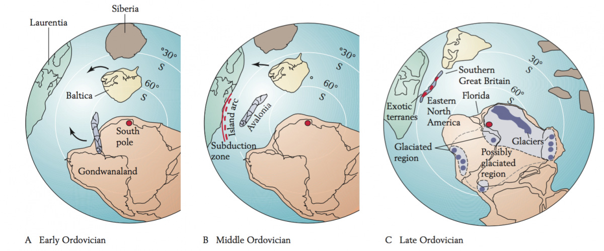
Around 540 million years ago (about 290 million years before the first dinosaurs), a volcanic island arc chain formed outboard of what is now the eastern United States. Gold was deposited alongside island arc basalts between cracks of the ancient seafloor. Then, changes in plate tectonics shoved the entire ocean floor, and eventually the volcanic island arc, underneath the southeastern edge of North America. During this period of intense metamorphism (which was caused by the collision of North America and the island arc), the volcanic gold deposits were reorganized and concentrated into the thin, stringy veins of quartzite that are found around Dahlonega today.
Paleotectonic reconstruction of plate boundary interactions affecting Dahlonega, GA during the Taconic Orogeny
This interpretation of the history of Dahlonega gold is based on comprehensive evidence from the rock record. The stratigraphy (where layers of rocks are found relative to when they were deposited and what other rocks surround them), chemistry, and physical characteristics of the rocks in and around Dahlonega all record the formation and filling of a back-arc basin during the Taconic orogeny(German 2013; Settles, Hatcher, and Bream 2002; Stone, 2012).
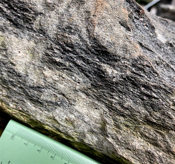
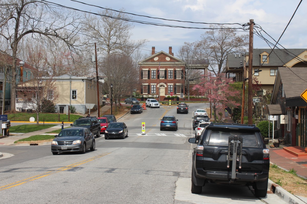
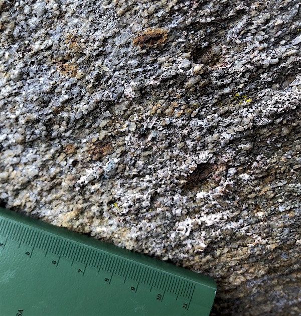
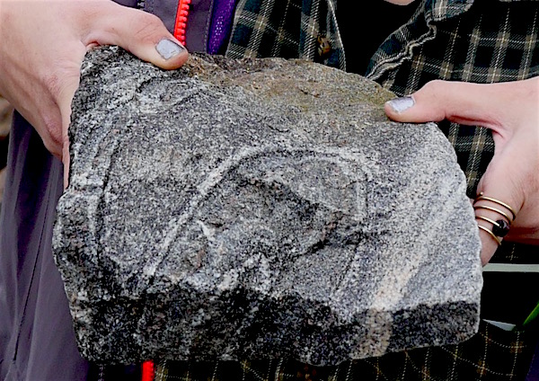
The rocks seen around the town of Dahlonega were strongly foliated (grains are very flattened by metamorphism) micaeous schists, including garnet schists. The high degree to which the grains of the parent schists have been flattened (foliated) and stretched is one of proxies geologists use to interpret the history of extreme metamorphism and deep burial that affected the Dahlonega gold deposits.Uphill view of Downtown Dahlonega, with the courthouse marking the top of the hill and the center of downtown.
Downtown Dahlonega
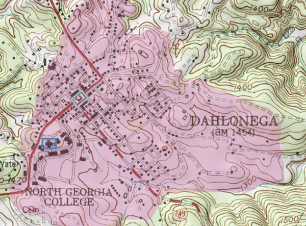
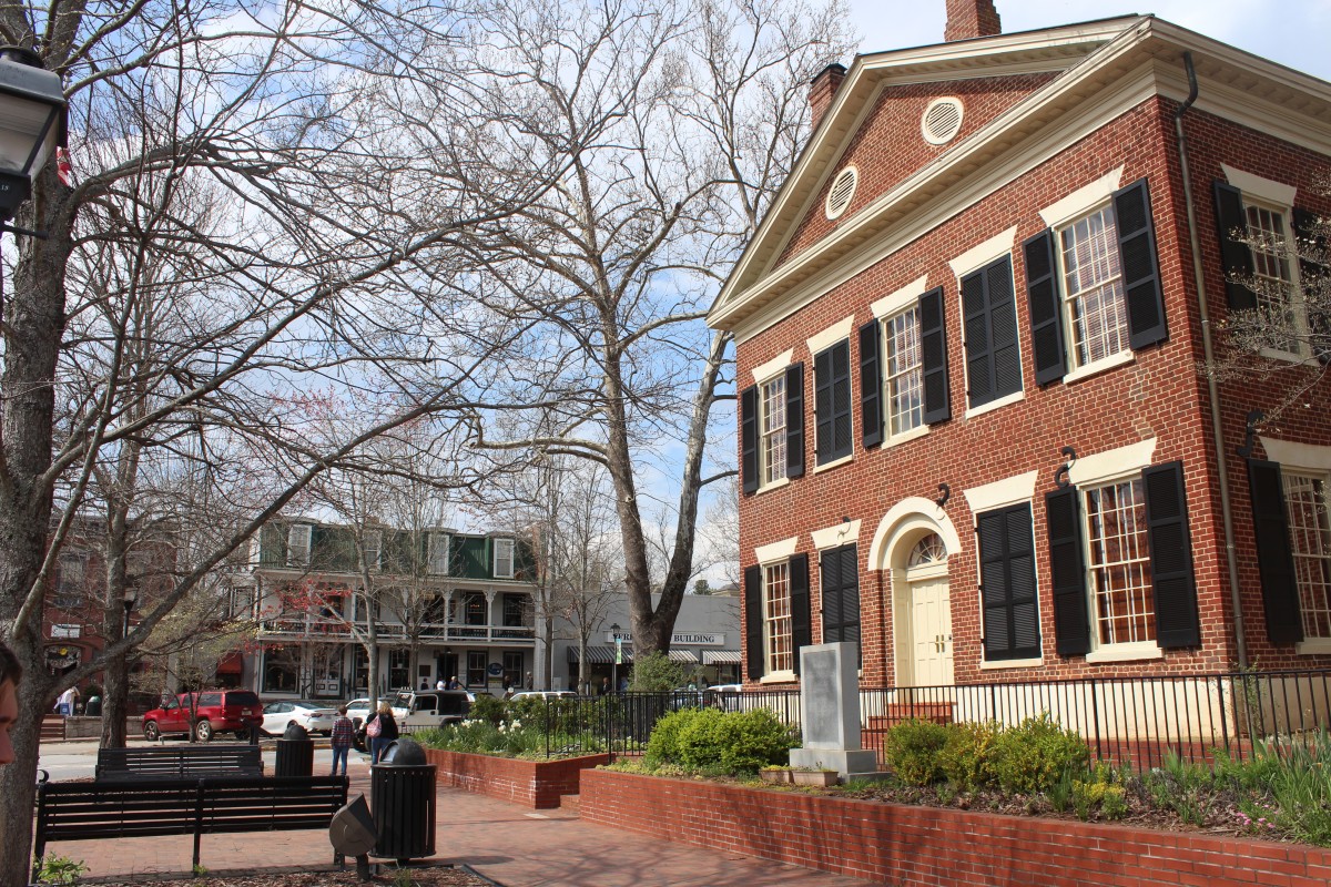
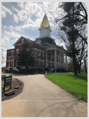
Located in the foothills of the Blue Ridge Mountains downtown Dahlonega is nestled by Crown Mountain from the southwest to southeast, Happy Hollow Hills northwest, and elevated terrain surrounding Lake Zwerner (also known as Ward Creek) to the northeast. Consequently, downtown Dahlonega sits relatively low to surroundings in a valley-like environment. However, the two most important historic buildings downtown are both on elevated terrain relative to the sites broader topographical depression (topo Map below highlights this depression in pink). The two buildings are the historic Dahlonega Court House also known as the Lumpkin County Courthouse (on topo map boxed in light blue) and Price Memorial Hall (on topo map boxed in royal blue). Originally a log courthouse, the brick replacement that stands today began construction in 1833 and was finished by 1836(Howard, 1929; Historic Preservation Commission, 2005). Locally made bricks from Yahoola Valley Farm (one mile away) formerly owned by Colonel Baker, cover all exterior facades(Howard, 1929). Now located in the center of town at the intersection of two main thoroughfares, Main Street and Chestatee Street, the courthouse was the first public downtown building from which the public square grew. Today, the urban scheme of downtown Dahlonega is gridded. The urban grid model was developed through the Public Land Survey System (PLSS) beginning in 1785, and popularized by Thomas Jefferson before the turn of the century. Subsequently many American towns have adopted this practical schema as their fundamental systematized geometry of urban planning, as is the case with Dahlonega.
Side view of the downtown Dahlonega historic courthouse.
As one of the first public buildings, the courthouse was once the site of slave auctions, local protests, and theatricals (Howard, 1929). Its’ central communal location is a common development pattern in the southeastern United States. If you think about it, it makes sense… law is the keystone of civilization. It is perhaps the defining social characteristic that separates us from other primates, stemming from our highly evolved written language. Laws have to be written down in order to be implemented, otherwise they are not part of our collective consciousness. While laws and politics are controversial they are extremely important in maintaining the system of life we operate in. As such it only seems fitting that the Dahlonega Courthouse would be at the very center of living in the town and on the relative highest bedrock. Even if we look outside the United States, say to the Romans, the Vatican in particular, St. Peter’s Basilica is the central building occupying the space of a governing body. In Rome, by law the dome of St. Peters must be the tallest built structure in the city. So while not necessarily on the highest point of elevation in Rome, no building’s height stands taller than that of the dome of St. Peters. Countless other examples exist throughout architectural and urban development history that demonstrate this idea of buildings of authority corresponding with high topographical placements. This is because height is seen as an advantage in virtually all realms of aesthetics. Height equates to visibility and dominance over one’s surrounding. Placement of buildings in relation to their topography may often say even more about the unseen superstructures at play than things like architecture. Once a building is built on this dominant terrain, all other buildings are secondary. Architects have often compensated for secondary placement with ostentatious displays of wealth through architecture. An example of this is Price Memorial Hall.
Price Memorial Hall, rebuilt in 1878, with gold steeple added in 1972. Photo taken April 2018.
Price Memorial Hall, on the outskirts of downtown Dahlonega is also on a high topographic point. While not on higher bedrock than the courthouse, the golden steeple surpasses it in materiality and overall landscape prominence. Coated with gold leafing from the surrounding hills, the steeple serves as a visual reminder of the late 19th century gold rush. While not part of the original design, the gold steeple was added later in 1972. The steeple is said to be the leafing of 13 ounces of gold (Noth, 1999). Today Price Hall is the administration building for the University of North Georgia, formerly North Georgia Agricultural College founded by Congressional Representative (1871) William Pierce Price (b.1835-d.1908). Price Hall is built on the foundation of the Civil War era United States Branch Mint, built in 1837. The mint was in operation until 1861 when it was seized by the Confederates.
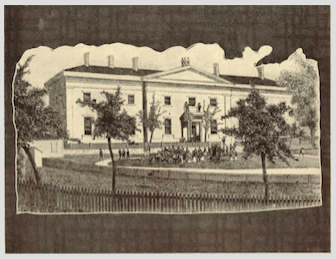
Civil War era United States Branch Mint, built in 1837
Ten years later, in the early seventies the mint building and ten acres of surrounding land were transferred to the state as part of the Federal Land-Grant College initiative to be used as an agricultural school (Historic Preservation Commission, 2005). During this time of transition the building was remodeled in the collegiate victorian style. This effort was largely led and funded by Price. On December 19th, 1877 the building was subject to a devastating conflagration, in the year following it was reconstructed exactly as it was before the fire (Howard, 1929). Such buildings demonstrate the importance of site to human development. On January 20th, 1972 the building was added to the National Register of Historic Places.
Side view of a general store that used to operate in Auraria. It was abandoned in the 80’s but is still standing to mark the former town today.
Auraria
Auraria is a present-day ghost town situated just south of the more well-known Dahlonega. Similar to Dahlonega, Auraria was a bustling gold mining town in its heyday, and was one of my towns that sprung up as a result of the Georgia Gold Rush of 1829 (Georgia Historical Commission, 1954). In 1832, Auraria was established as the county seat of Lumpkin County and boasted a tavern, hotel, and some small buildings to temporarily house the large influx of miners during the time. The demand for space was so high that a lottery, named the Georgia Gold Lottery of 1832, was held to distribute land, including land that was owned by Cherokee Indians. By May 1833, the population grew to be a tenth of the entire population in the county (10,000).
Half of the land just east of Auraria and noted on the historical marker of the town was purchased by then-Confederate Vice President John C. Calhoun. The Calhoun Mine was mined by slaves, which is unsurprising given the fact that Calhoun was a staunch defender of slavery.
More gold mines sprung up around the area, especially along the local creeks and rivers like the Etowah River and Camp Creek. The 40-acre gold lot that Auraria stood on was won by a man named John R. Plummer in the Georgia Gold Lottery. However, there were doubts regarding his qualifications for being able to participate in the lottery. Because many businesses and miners were pouring into the area, they chose to locate elsewhere for business due to Plummer’s legal debacle. Over time, the exodus of businesses northwards from the town took a permanent toll on the town which had no other economic means to boast besides gold mining. Having lost miners to more stable towns in the North, Auraria eventually lost its county seat to Dahlonega, and fell into deep decline.
Inside view of Woody’s convenience store in ghost town Auraria, with a good number of items and store merchandise still intact.
Today, Auraria is a ghost town at the intersection of Castleberry Bridge Rd and Auraria Rd (also known as State Route 9E). All that stands today are a few homes, an abandoned hotel that is very unsafe to enter formerly called Graham’s Hotel, and Woody’s Convenience Store, which has many items still remaining in the store.
Contributors: Maya Bradford, Graham Stopa, Angela Jiang
German, J.M. (2013). The Dahlonega gold belt. Georgia Geological Society Guidebook, 33(1), 9-22.
Historic Preservation Commission. (2005). Lumpkin County Comprehensive Plan 2004-2025. Dahlonega, GA: The Historic Preservation Commission.
Howard, A. H. (1929). Georgia Homes and Landmarks. Atlanta, GA: Southern Features Syndicate.
Mooney III, B.H. (1999). Rome News Tribune. Rome, GA: New Publishing Co.
Settles, David J., R. Hatcher, Jr., and B. Bream. (2002). The Hayesville–Soque River and Allatoona faults and an Ordovician arc assemblage in the central Blue Ridge northwest of Dahlonega, Georgia. Georgia Geological Society Guidebooks, 22(1), 17-42.
Stone, P. (2012). The demise of the Iapetus Ocean as recorded in the rocks of southern Scotland. Open University Geological Society Journal, 33(1), 29-36.
The Tallulah Falls Formation is an extensive rock unit that makes up a dome surrounding the greater area of the park. Because the Tallulah Falls dome is a dome feature, the youngest member of the Tallulah Falls Formation, which is a quartzite schist, is exposed at the top of the dome (where the state park is located). The rocks making up the Tallulah Falls dome include (from oldest to youngest) a graywacke-shist amphibolite, a garnet alumnious schist, a graywacke schist, and a quartzite schist.
(Tallulah Gorge State Park, Waypoint 033) Granular texture of Tallulah Falls quartzite schist. Note the large, elongated grains that are oriented parallel to each other. I think you can see the familial resemblance to sandstone, except schist is way harder.
These rocks were most likely formed between 1180 and 1120 million years ago during a period of diverse magmatism that occured along the entire eastern edge of North America after the assembly of the supercontinent Rodinia. Doming of the Tallulah Falls formation occured around 270 million years ago during the assembly of the supercontinent Pangea (Hynes and Rivers, 2010).
The Tallulah Gorge was subsequently formed by the slow, relatively recent erosion of the Tallulah river, which somehow managed to cut through 300 meters of incredibly hard Tallulah quartzite. The quartzite beds seemed to be south-dipping on the overlook at Waypoint 033 and in a uniform unit; the tilted nature of the beds may be evidence of Taconic or Alleghanian ductile deformation that thrust the rocks forward and overturned them during massive mountain building events when the Appalachians were as tall as the Himalayas.
Tallulah Falls: Where Are the Plants?
As stated, the Tallulah Falls Formation is composed of a series of different types of rocks, mainly schists. Weather, water, and biota eventually break rock down into saprolite, decomposing rock, and then soil. However, this is an arduous process which does not occur in a short span of time.
It all starts with primary succession, which is the beginning of ecosystem development on solid rock (Walker and Moral 2003). Although succession is complex and often non-linear, its simplest trajectory is from small biota such as bacteria to larger organisms such as fungi and then onto plants spanning from grasses to trees (Walker and Moral 2003). All landscapes with large amounts of plant matter and well-developed ecosystems originated from primary succession.
Tallulah Falls has gone and is going through primary succession. The park is quite varied, featuring everything from stark slabs of stone to tall hardwoods such as red oak. Some stone-covered areas have already started to become more varied, featuring lichens and small grasses. Over the next century, those areas may become as forested as the neighboring tree-filled patches.
Given the nature of succession, it is possible that all of Tallulah Falls will be covered in soil and plant matter. It will just be on a much, much larger time scale than any single human can observe.
Overview of the Park
Tallulah Gorge State Park is located in Rabun County and was established in 1993. Its original and current acreage is 2, 710 acres. In 1905, the discussion began in regards to its creation by the wife of General Longstreet, Helen Dortch Longstreet. In 1911, Georgia Power bought the land around the Gorge to use it as a source of electricity. The gorge is around 2 miles long and 1,000 feet deep, with five waterfalls from the Tallulah River to Tugaloo Lake. The gorge is home to the Green Salamander and Monkeyface Orchid, both endangered species. The gorge also offers recreational activities for tourists such as rock climbing and white-water rafting.
Contributors: Maya Bradford, Katya Miranda, Jessie Moore
References.
History of the Georgia State Parks and Historic Sites Division. (n.d.). Retrieved from http://gastateparks.org/
Hatcher, R. D. (1976). Introduction to the Geology of the Eastern Blue Ridge of the Carolinas and nearby Georgia. Carolina Geological Society Field Trip Guidebooks.
Hynes, A., & Rivers, T. (2010). Protracted continental collision — evidence from the Grenville Orogen. Canadian Journal Of Earth Sciences, 47(5), 591-620. doi:10.1139/E10-003
Walker, L. R., & del, M. R. (2003). Primary succession and ecosystem rehabilitation. Retrieved from https://ebookcentral.proquest.com
The parent rocks surrounding Lake Chatuge, which are metamorphic schists and gneisses, were originally sedimentary rocks made of 2.8 billion year old sand. These sedimentary rocks began metamorphosing sometime between 1.5 and 1 billion years ago during the formation and rifting of the supercontinent Rodinia, and continued metamorphosing 440 million years ago during the collision of a volcanic island arc with the eastern edge of North America.
The most extensively exposed parent rock around Lake Chatuge is a well-banded biotite gneiss. This unit underlies most of Lake Chatuge, and the unit has good exposures on the shoreline. Outcrops are gray, well-banded (with bands less than 5 mm thick), with reddish-brown anhedral garnet porphyroblasts, and weather into a reddish-brown saprolite. We did not encounter any true outcrops around the Chatuge Dam, but the shorelines around the dam were lined with heavy riprap. The riprap was largely composed of biotite gneiss, which is believed by the author to be the aforementioned biotite gneiss parent.
Well-banded biotite gneiss where the light colored quartz and feldspars have segregated into layers distinct from the dark colored biotite and amphibole layers. Here you can see that after the separation of the minerals into layers, the layers were folded intensely, indicating high plasticity during ductile Taconic or Grenville-aged deformation
There is a band of ultramafic rocks called the Lake Chatuge Complex that extends from the southwestern to northeastern corners of the Lake Chatuge area. An ultramafic rock is one whose mineral composition is dominated by dark-colored minerals concentrated close to the core of the earth. Because mafic minerals are located so deep beneath the earth’s surface, a predominately mafic rock comes from spreading centers or deep underwater volcanos. The Lake Chatuge Complex is one of the many instances in the southern Appalachians were a chunk of igneous rock from deep in the ocean was subducted and shoved uncomformably between an assemblage of light-colored, less dense continent-derived rock (Kolsrud and others, 2001).
The only quartzite deposit of potential economic significance in the Lake Chatuge complex is a steeply dipping lens-shaped body that outcrops on the top of Bell Mountain. The body is 500 feet wide, 1,600 feet long, and has an unknown depth. The color ranges from pure white to pink to yellow.
Botany of Bell Mountain
The genus trillium includes a wide variety of three-leafed, short plants with flowers at the center. (Wade, McDowell, Beckgam, Crisafulli, & Pennisi 2014). In North Georgia, a couple of examples of these plants include Trillium cuneatum or Sweet Betsy and Trillium luteum or Yellow Wakerobin (Wade et al. 2014). Both of these flowers grow in moist, hardwood forests with soil rich in organic matter, typically in floodplains (Wade et al. 2014). For reference, this is the description of T. cuneatum Wade et al. (2014) provide on page 140:
[The plant features] three large oval leaves, 6 inches long and 4 inches wide, [which] are arranged in a whorl at the top of stalks rising 3 to 12 inches above the ground. The leaves are sessile and mottled gray-green.
Given that they are relatively similar, they will both be referred to as “trillium” from this point on.
The reason trillium is being discussed in the context of Bell Mountain is that the plants were found growing on the slope of the mountain alongside the road. This is unusual, given that there were no streams nearby. Furthermore, Bell Mountain has an exceptionally steep slope. If this is the case, how do the conditions of Bell Mountain mimic a floodplain?
It is possible that trillium can grow here because of the high moisture level, overland flow, thick layer of leaf litter. During the day of research, it was observed that Bell Mountain was very foggy. This is likely the case after rain events in general, as was noted. The general amount of moisture in the air contributes to trillium’s ability to grow on the mountain slope.
The overland flow and leaf litter work in conjunction with one another to provide rich, wet soil for the plants to grow in. During and after any rain, the large layer of leaf litter will do an excellent job of capturing the vast majority of the overland flow. In turn, there is such a large amount of overland flow due to the steep slope—the land is not flat enough for the water to pool in any depressions.
Though it may be an unusual location for trillium to grow, Bell Mountain is well-suited habitat. The general moisture level as well as the leaf litter and high amounts of overland flow allow for trillium to grow in healthy abundance.
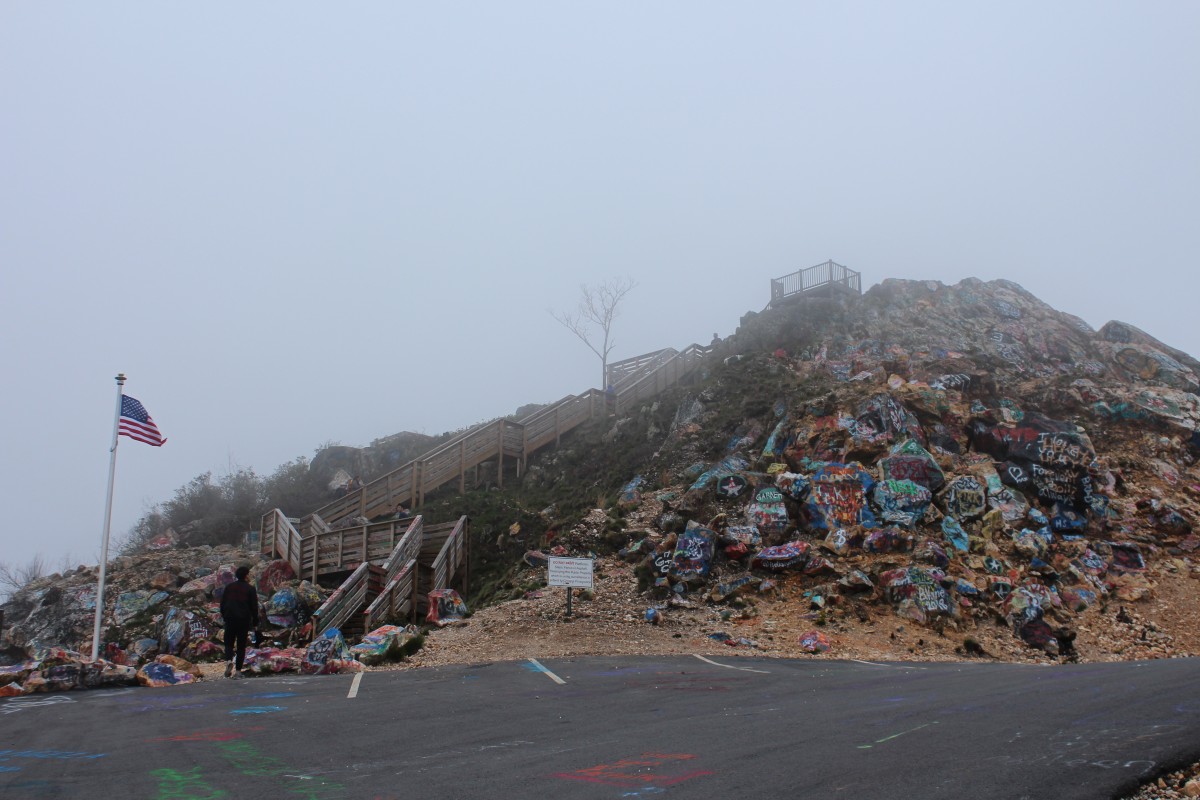
Bell Mountain can be viewed from afar as notable not just for its impressive height, but for a noticeable gouge at the peak.
Human History of Bell Mountain
Bell Mountain, known as Bell Knob on U.S. Geological Survey topological maps, is a 3,420 foot mountain in Hiawassee Mountain that overlooks Lake Chatuge and the impounded Hiawassee River. Upon viewing it from a distance, Bell Mountain’s top is curved out like a large sliver of it was scooped away. This can be explained for: in the 1960’s, three men hailing from Murphy, North Carolina–namely, Grover C. Mauney, Walter Mauney, and Dr. William A. Hoover–started the Hiawassee Stone Co., with the intentions of mining the top of Bell Mountain for commercial quartzite and silica. Even though Bell Mountain poses a sizable erosion danger to Lake Chatuge below, the stone company permanently damaged the top of the mountain by gouging out its crest. However, in the very next year after the start of their company, a University of Georgia professor conduced a Department of Commerce study for the local region and concluded in the study that “a market does not exist for the Bell Mountain silica.” Given this poor economic planning, the Hiawassee Stone Company obviously did not last long. However, the dynamited section of the Bell Mountain crest can still be seen today, and from miles away. The human alteration to the top of the mountain also heightened water quality issues in the local region.
The ownership of Bell Mountain, like the road leading up to its peak, is convoluted and recently switched again. Bell Mountain was owned by the Georgia Baptist Association Inc., until 1971 when Atlanta advertising executive and Young Harris resident Hal Herrin bought it for $60,000. Herrin bought the land lot for the purposes of preservation, given its exploitation by the Hiawassee Stone Co., in the hands of the Georgia Baptist Association. However, when Bell Mountain was in Herrin’s hands, the mountain face was deeply disturbed by extensive off-road driving. Most recently in 2016, the mountain was gifted by the Hal Herrin Estate to Towns County. In dealing with the deep off-roading troughs, the then-Towns County, Bill Kendall, announced a $150,000 budget to build a paved road leading up to the mountain and a wooden observatory deck for safe 360′ views of the region.
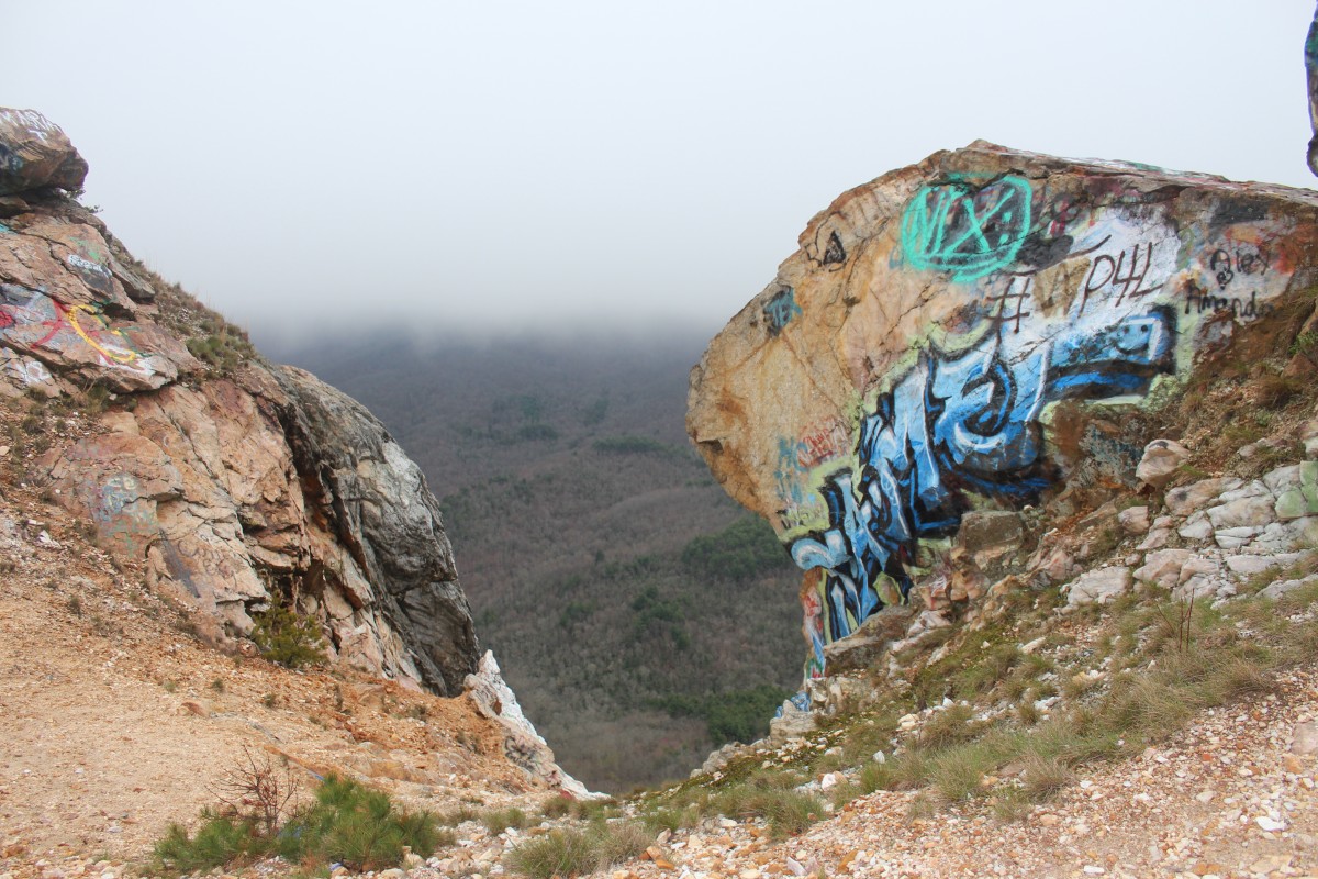
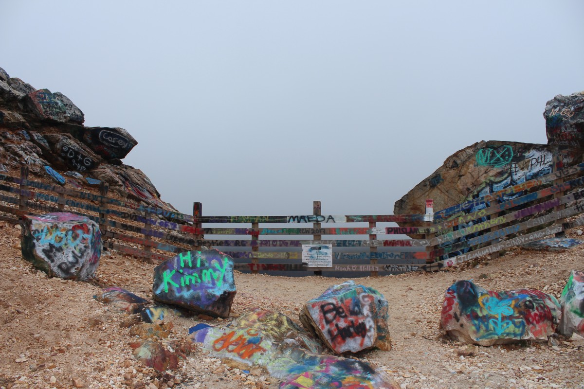
Graffiti on the rocks.A wooden platform observatory is located at the top of the peak–we promise!
Today, vehicles can now be driven up the face of the mountain on a well-paved road and hikers can challenge themselves post steep hike up the mountain to climb the observatory deck for priceless views of the Hiawassee Lakes region. Another notable feature on the top of the mountain is the extensive graffiti on rock faces, a tradition that apparently was started 20-30 years ago by locals and is a topic of extensive debate regarding its value.
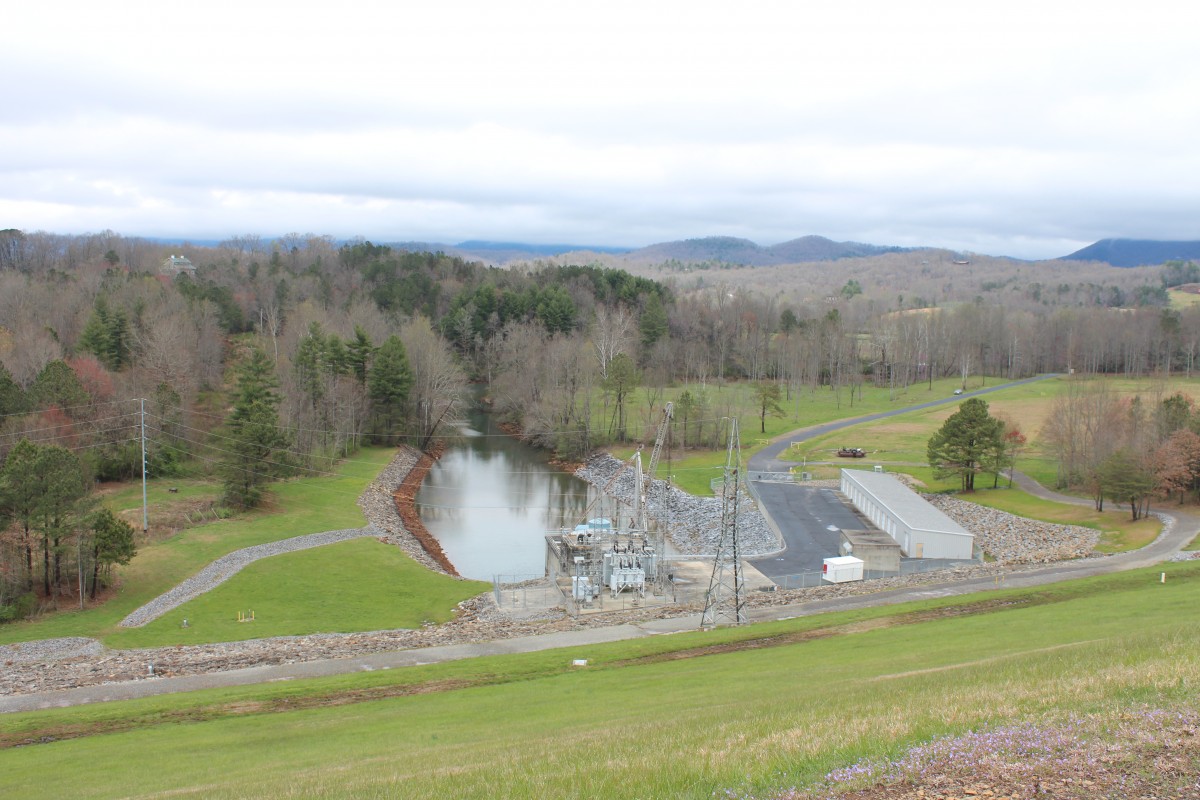
View of the stream channel uphill from the Chatuge Lake dam.
Human History of Chatuge Dam
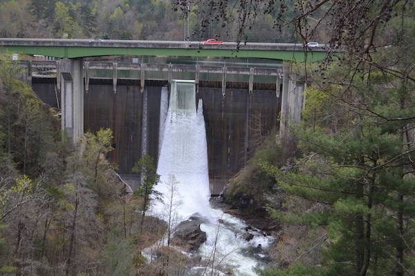
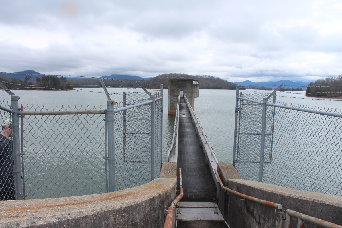
Chatuge Dam, named after a former 18th century Cherokee settlement once situated near the dam site, is one of three dams owned by the Tennessee Valley Authority (TVA). The TVA was established in the aftermath of the Great Depression in 1933 to provide flood mitigation, electricity generation, and economic development amongst many other purposes to the Tennessee Valley region. Chatuge Dam, which straddles both Tennessee and Northeast Georgia, is the highest of the three dams, impounding the 7,000 acre Lake Chatuge.
Originally, the dam was built to mitigate flooding in towns down from the lake. However, like many other TVA developments, the dam was outfitted with a small hydropower output in the 1950s. The hydropower project was actually authorized in the early 1940s in order to meet emergency electricity demand in the wake of World War II. The town of Hiawassee is located just south of the dam, and the Georgia border of the dam includes the Chattahoochee National Forest.
The dam itself was constructed in a “ski jump” spillway style out of earth and rock. The spillway boasts 50 bays with a total discharge of 11,500 cubic feet per second, with a flood storage of over 132 miles of shoreline. The “ski jump” spillway is 44 meters high and 2,850 feet wide. The entire style was kept relatively simple given the short timeline imposed by wartime needs.
Contributors: Maya Bradford, Angela Jiang, Katya Miranda
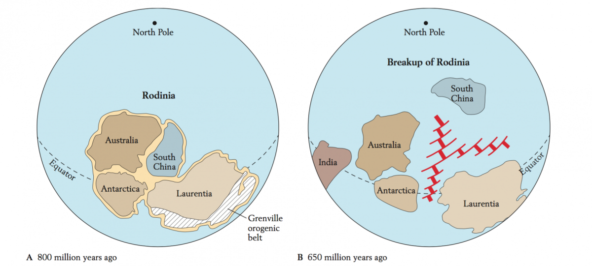
The Appalachian Mountains were built on the margin of Laurentian over four successive orogenies: the Grenville (Proterozoic — late Precambrian), the Taconic (Ordovician), the Acadian (late Silurian — early Devonian), and the Alleghenian (late Paleozoic). Of these orogenies, the events that most effect the North Georgian Appalachians are the Grenville orogeny (Proterozoic — Late Precambrian), the Taconic orogeny (Ordovician) and the Alleghanian orogeny (late Paleozoic). Evidence of the Acadian orogeny in the Southern Appalachians is problematic (Casale and others, 2017).
GRENVILLE OROGENY (Proterozoic — late Precambrian)
Mountain building associated with the Grenville orogeny occurred over 1.5 to 1 bya (Proterozoic — Late Precambrian) and is associated with the assembly and rifting of Rodinia. The basement of the North Georgia mountains – dominated by granitic plutons and high-grade orthogneiss – formed during a continental collision associated with the assembly of Rodinia over one billion years ago (Chakraborty and others, 2012). The Tallulah Falls Dome granite formed after the assembly of Rodinia during a period of diverse magmatism that occurred along the entire Laurentian margin between 1180 and 1120 ma (Hynes and Rivers, 2010). The Grenville orogenic belt rifted apart at the end of the Precambrian about 600 mya, forming an ancient sea. Dahlonega gold was formed later in the Ordovician due to back-arc associated volcanism and deposited between cracks of what was then seafloor (German, 1989)
TACONIC OROGENY (Ordivician)
After the rifting of Rodinia, the tectonic setting on the eastern edge of Laurentian shifted from a passive margin, to a subduction zone, which carried an island arc formed in the middle of the pre-Atlantic ocean back to Laurentia and caused a collision and associated mountain building event called the Taconic orogeny. Garnet-to-sillimanite grade Paleozoic amphibolite facies and high grade gneiss metamorphism is recognizable throughout the North Georgia mountains, as noted by Hatcher (1971); these structures are indicative of the subduction zone and arc accretion associated with the Taconic orogeny.
ALLEGHANIAN OROGENY (late Paleozoic)
In the late Paleozoic (270 mya), the collision of Gondwana and the assemblage of the supercontinent Pangea created a huge fold and thrust belt that placed the crystalline basement of the Blue Ridge on the Laurentian margin. Widespread plutonism occurred in the North Georgia Mountains during this orogeny. Rifting occurred throughout the Mesozoic, culminating in the formation of the Atlantic Ocean. This tectonic activity marks the Southern Appalachians with normal-fault-bounded grabens, basaltic dikes (Triassic) and fluvial lake deposits (Triassic).
While the Tallulah Falls dome granite formed during the Grenville orogeny, doming occurred early in the Alleghenian orogeny along with other domes that formed in the eastern Blue Ridge at that time.
References
Casale, G., Levine, J. F., Craig, T. D., & Stewart, C. (2017). Timing and deformation conditions of the Tallulah Falls dome, NE Georgia: Implications for the Alleghanian orogeny. Geological Society Of America Bulletin, 129(9/10), 1195-1208. doi:10.1130/B31595.1
Chakraborty, S., Moecher, D. P., & Samson, S. D. (2012). Provenance of the Lower Ocoee Supergroup, eastern Great Smoky Mountains. Geological Society Of America Bulletin, 124(7-8), 1278-1292. doi:10.1130/B30578.1
German, J. M. (1989). Geologic setting and genesis of gold deposits of the dahlonega and carroll county gold belts, georgia. Economic Geology and the Bulletin of the Society of Economic Geologists, 84(4), 903-923. http://dx.doi.org.proxy.library.emory.edu/10.2113/gsecongeo.84.4.903
Hynes, A., & Rivers, T. (2010). Protracted continental collision — evidence from the Grenville Orogen. Canadian Journal Of Earth Sciences, 47(5), 591-620. doi:10.1139/E10-003